Home
All Products
Historic Maps
American Indian Maps
Birds Eye View Maps
Civil War Maps
Panoramic Maps
Railroad Maps
Revolutionary War Maps
State Maps
Historic Prints
Civil War Prints
Civil War Posters
Historic Portraits
Presidential Portraits
Contact Us
0
0
press
Enter
to search
Showing all results:
No products found.
Home
/
American Indian Maps
/
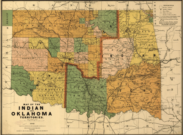
Map of the Indian and Oklahoma territories
$
17.95
–
$
47.95
SKU: im0010
Paper Size
Choose an option
12" x 18"
18" x 24"
24" x 36"
Clear
Quantity
Qty
Add to cart
Description
CREATED/PUBLISHED [S.l.], 1892.
SKU:
im0010
Category:
American Indian Maps
Related products
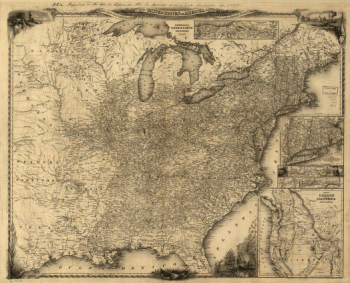
A new map for travelers through the United States of America
$
17.95
–
$
47.95
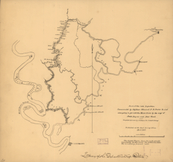
Route of the late expedtion
$
17.95
–
$
47.95
Pensilvania, Nove-Cesarea, Novi-Eboraci, Aquanishuonige et Canada
$
17.95
–
$
47.95
A new and accurate map of New Jersey, Pensilvania, New York and New England with the adjacent countries
$
17.95
–
$
47.95
Search Product or SKU
×
Home
All Products
Historic Maps
American Indian Maps
Birds Eye View Maps
Civil War Maps
Panoramic Maps
Railroad Maps
Revolutionary War Maps
State Maps
Historic Prints
Civil War Prints
Civil War Posters
Historic Portraits
Presidential Portraits
Contact Us
Cart
0
Cart
Close
Updating…
No products in the cart.
Continue shopping