This CD contains 67 rare antique maps of Indian Land Cessions in the United States in MrSid format. This format allows you to see the entire map or drill down for the smallest details. If you printed one of these maps at full size, it would be about 36″x36″ or larger (way more than can fit on a computer screen) so you can imagine how much detail they all have. (MrSID software is included on the CD.)
The table below shows the description and a small image of each map on this incredible history CD.
|
Alabama |
Alabama (northern portion) |
Arizona 1 |
|
Arizona 2 |
Arkansas 1 |
Arkansas 2 |
|
California 1 |
California 2 |
Colorado 1 |
|
Colorado 2 |
Dakota 1 |
Dakota 2 |


|
Dakota 3 |
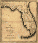
Florida |
Georgia |
|
Idaho |
Illinois 1 |
Illinois 2 |
|
Indiana |
Indiana (detail) |
Indian Territory 1 |
|
Indian Territory 2 |
Indian Territory 3 |
Iowa 1 |


|
Iowa 2 |
Kansas 1 |
Kansas 2 |
|
Louisiana |
Michigan 1 |
Michigan 2 |
|
Michigan (Saginaw bay to Lake Erie) |
Michigan (region about Mackinac and Detroit) |
Minnesota 1 |
|
Minnesota 2 |
Minnesota (northern portion) |
Mississippi |


|
Missouri 1 |
Missouri 2 |
Montana 1 |
|
Montana 2 |
Nebraska |
Nebraska (eastern portion) |
|
Nevada |
New Mexico 1 |
New Mexico 2 |
|
New Mexico and Texas (detail) |
New York |
North Carolina |


|
Ohio |
Ohio (detail) |
Oregon 1 |
|
Oregon 2 |
Pennsylvania |
Tennessee and bordering States |
|
Tennessee (detail) |
Tennessee and Alabama (portions of) |
Texas (portion of) |
|
Utah 1 |
Utah 2 |
Washington 1 |


|
Washington 2 |
Washington (along Admiralty inlet) |
Washington (northwestern) |
|
Wisconsin 1 |
Wisconsin 2 |
Wyoming 1 |
|
Wyoming 2 |


This is a must have collection for any american indian map history buff!