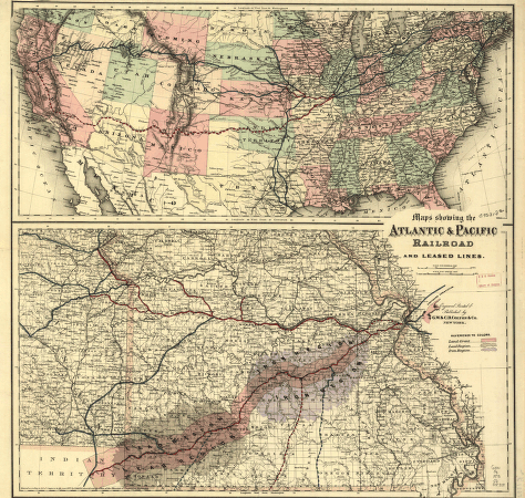
Maps showing the Atlantic & Pacific Railroad and leased lines. Special map shows the main line and land grant in Missouri and includes iron and lead regions; general map covers United States showing the railroad network with the main lines distinguished by color; created by Act of Congress, July 27, 1866, with a land grant of 42 million acres; entry 329 shows extent of land grant in Arizona and New Mexico. G.W. & C.B. Colton & Co. CREATED/PUBLISHED New York, 1873. Scale ca. 1:150,000 and ca. 1:7,000,000.
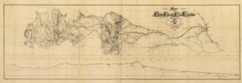
Chicago & Pacific Railroad
$17.95 – $47.95
SKU: rrac53
Related products
-

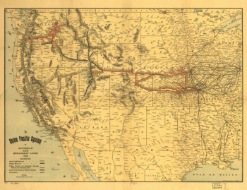
Union Pacific Railroad Company
$17.95 – $47.95 -
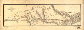
West Philadelphia Rail Road Company
$17.95 – $47.95 -
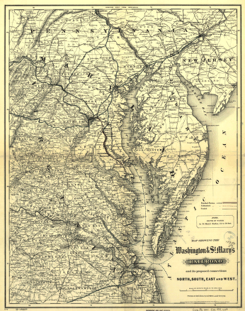
Washington and St
$17.95 – $47.95 -
Union Pacific Railroad Company
$17.95 – $47.95