With part of Pensilvania, and the province of Quebec. Drawn by Capt. Holland. Engraved by Thomas Jefferys, geographer to His Majesty. And improved from the modern surveys of those colonies down to the year 1775. Holland, Samuel, 1728-1801. CREATED/PUBLISHED London, Printed for Robt. Sayer & John Bennett, 1775. NOTES Scale ca. 1:650,000. Hand colored. Relief shown pictorially. Shows 'Longitude west from London.' Shows township and county boundaries. Includes historical notes and insets of 'A chart of the mouth of Hudson's River, from Sandy Hook to New York,' 'A plan of the city of New York,' and 'Plan of Amboy with its environs.'

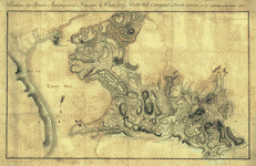
The provinces of New York, and New Jersey
$17.95 – $47.95
SKU: rwnyar104200
Related products
-

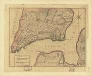
A plan of the city and environs of New York in North America
$17.95 – $47.95 -
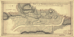
Position des Armees ameriquaine et francoise a Kings-ferry
$17.95 – $47.95 -
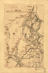
Map of Orange and Rockland counties area of New York
$17.95 – $47.95