Showing its connection with other railroads. T. J. Carter, engineer. On stone by J. E. Moody.Carter, T. J., fl. 1844-1873. CREATED/PUBLISHED Boston, Bufford & Co.'s Lithography, 1845. SUMMARY Map showing parts of Massachusetts, New Hampshire, and Maine indicating county lines, cities, towns, and the railroad network. NOTES Scale 1:190,080; 3 miles to an in. Oriented with north to the right. Relief shown by hachures.
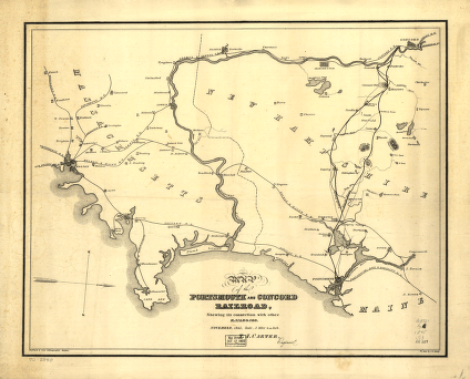
Portsmouth and Concord Railroad
$17.95 – $47.95
SKU: smnh64
Related products
-

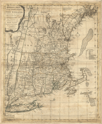
Bowles's map of the seat of war in New England
$17.95 – $47.95
![Bird's eye view of the village of Lancaster, Coos County, N.H. 1883. [Drawn by] A. F. Poole. Beck & Pauli, lithographers.](https://www.ushistoricalarchive.com/wp-content/uploads/nc/data/products/im/sm/nh/b52-350x265.gif)