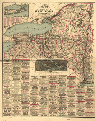
[by Van R. Richmond, State Engr. & Surv.] CREATED/PUBLISHED New York, 1869. SUMMARY Map of New York State and vicinity showing drainage, canals, cities and towns, and named railroads. January 1st, 1870 edition has 'W. B. Gilbert, Chief Engineer.' NOTES Scale ca. 1:1,000,000. Inset: [Great Lakes]

Map showing the location of the N.Y. & Oswego Midland R.R. with existing and proposed connection, January 1st 1869
$17.95 – $47.95
SKU: smny31
Related products
-

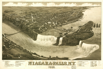
Niagara-Falls, N.Y. 1882. H. Wellge del. Beck & Pauli Lith.
$17.95 – $47.95 -
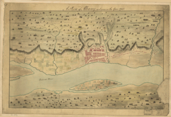
A Plan of Albany, as it was in the year 1758.
$17.95 – $47.95 -
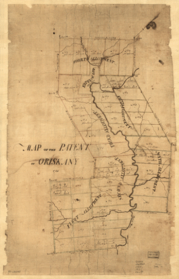
Map of the patent of Oriskany.
$17.95 – $47.95