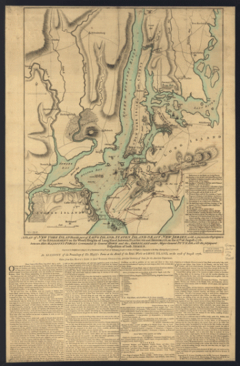
On the North or Hudsons River, and to Crown Point, on the East or Sound River, shewing the several streets, publick buildings, docks, fort & battery, with the true form & course of the commanding grounds, with and without the town. Survey'd in the winter, 1775 [i.e. 1766] P. Andrews, sculp. Montrésor, John, 1736-1799. CREATED/PUBLISHED [London]; Sold by A. Dury [1775] NOTES Scale ca. 1:6,300. Relief shown by hachures. Depths shown by form lines. Dedicated to Major Gen. Thos. Gage. Includes descriptive note, 'References,' and inset 'A chart of the entrance to New York from Sandy Hook, shewing the properest channel for sailing, with ye banks and depths of water' ca. 1:128,000.
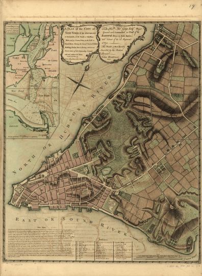
A plan of the city of New-York & its environs to Greenwich
$17.95 – $47.95
SKU: smnyc44
Related products
-

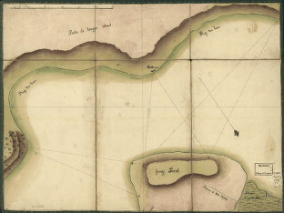
Frog's Point avec batteries de Partie de Longue Island.
$17.95 – $47.95 -
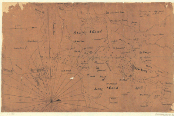
Environs de New-York, de Long-Island, etc.
$17.95 – $47.95