Constructed under the direction of Brig. O. M. Mitchell, by Col. Charles Whittlesey in 1861: repaired and extended under the direction of Major Genl. H. G. Wright commanding Department of the Ohio, by Maj. J. H. Simpson, Chief Topogl. Engr. of the Dept. Bvt. Capt. W. E. Merrill, & Lieut. J. A. Tardy, Corps of Engs., and Col. Chas. Whittlesey, in 1862. Complied by order of Maj. Genl. H. G. Wright commanding Department of the Ohio, chiefly from surveys made under the direction of Maj. J. H. Simpson by W. H. Searles, G. A. Aschbach, O. P. Ransom, and J. R. Gillis, in Septr. & Octr. 1862. Published by authority of the Hon. the Sec. of War, in the office of the Chief of Engineers, U.S. Army. United States. Army. Corps of Engineers. CREATED/PUBLISHED [S.l.], office of the Chief of Engineers, U.S. Army, 1877. NOTES Scale ca. 1:16,000. Detailed map showing batteries and rifle pits, common and military roads, turnpikes, city streets and names, bridges, ferries, rural houses and names of some residents, drainage, vegetation, towns, and relief by hachures.
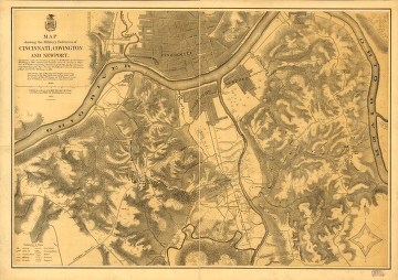
Map showing the military defences of Cincinnati, Covington and Newport
$17.95 – $47.95
SKU: smoh73
Related products
-

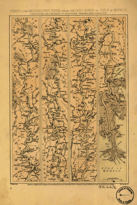
Mississippi River from the Ohio River to Gulf of Mexico
$17.95 – $47.95 -
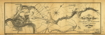
Connection of the Baltimore and Ohio rail road
$17.95 – $47.95 -
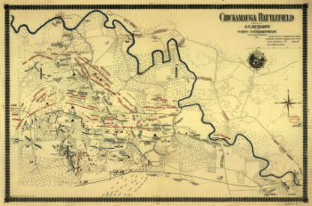
Chickamauga battlefield
$17.95 – $47.95