Compiled from surveys of portions of St. Andrews and Christ Ch. parishes by Lieut. John Johnson, C.S. Engrs., the harbor, James Id., Folly Id., Morris Id., Sullivans Id., & Long Id., from U.S. Coast Survey, Johns Id., from Mills Atlas. Under the direction of Maj; Wm. H. Echols, C.S. Engr. Corps, by Wm. A. Walker, Draughtsman, C.S. Engr. Corps. Drawn by John R. Key, 2nd. Lieut., C.S. Engr. Charleston, S.C., Nov: 28th, 1863. CREATED/PUBLISHED [S.l., 1885] NOTES Scale 1:63,360 (not '2 inches to 1 mile'). Detailed map showing forts and batteries, roads, railroads, towns, houses and names of residents, vegetation, drainage, and soundings in Charleston Harbor and offshore.

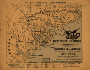
Map of Charleston and its defences
$17.95 – $47.95
SKU: smsc42
Related products
-

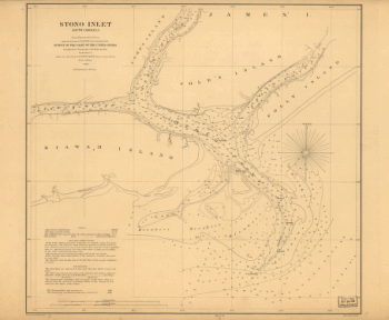
Stono Inlet, South Carolina
$17.95 – $47.95 -
British and French settlements in North America
$17.95 – $47.95
![Sketch showing position of besieging batteries. [Fort Sumter] April 12-13, 1861 Bowen & Co., lith., Phila.](https://www.ushistoricalarchive.com/wp-content/uploads/nc/data/products/im/sm/sc/b45.gif)