Home
All Products
Historic Maps
American Indian Maps
Birds Eye View Maps
Civil War Maps
Panoramic Maps
Railroad Maps
Revolutionary War Maps
State Maps
Historic Prints
Civil War Prints
Civil War Posters
Historic Portraits
Presidential Portraits
Contact Us
0
0
press
Enter
to search
Showing all results:
No products found.
Home
/
State Maps
/
Tennessee
/
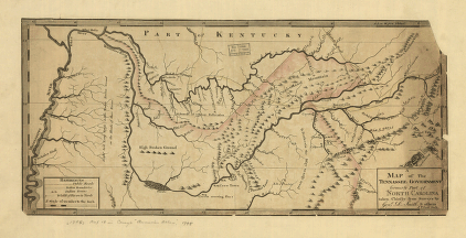
A map of the Tennessee government, formerly part of North Carolina
$
17.95
–
$
47.95
SKU: smtn7
Paper Size
Choose an option
12" x 18"
18" x 24"
24" x 36"
Clear
Quantity
Qty
Add to cart
Description
Reid, John, publisher. CREATED/PUBLISHED [S.l., 1795]
SKU:
smtn7
Category:
Tennessee
Related products
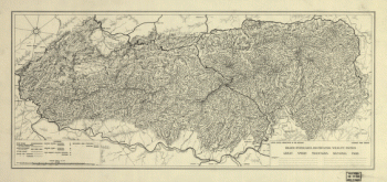
Great Smoky Mountains National Park
$
17.95
–
$
47.95
Plat of Murfreesboro. Taken from a top'l. sketch of Murfreesboro and its environs
$
17.95
–
$
47.95
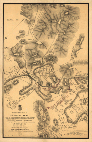
Battlefield in front of Franklin, Ten. November 30th, 1864
$
17.95
–
$
47.95
Harriman, Tenn. 1892. Drawn & published by Geo E. Norris. Burleigh Lith. Co.
$
17.95
–
$
47.95
Search Product or SKU
×
Home
All Products
Historic Maps
American Indian Maps
Birds Eye View Maps
Civil War Maps
Panoramic Maps
Railroad Maps
Revolutionary War Maps
State Maps
Historic Prints
Civil War Prints
Civil War Posters
Historic Portraits
Presidential Portraits
Contact Us
Cart
0
Cart
Close
Updating…
No products in the cart.
Continue shopping