Illustrating the positions of Baird's & Wood's div's., Nov. 23, 24 and 25, 1863. Julius Bien & Co. CREATED/PUBLISHED [S.l.], Julius Bien & Co., photo. lith., [18-?] NOTES Scale ca. 1:11,800. Shows topography by contours, drainage, roads, railroads, and dwellings with names of inhabitants. Names of corps and commanding officers are given. Arrows indicate battle movements.
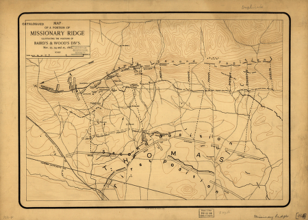
Map of a portion of Missionary Ridge
$17.95 – $47.95
SKU: smtn83
Related products
-

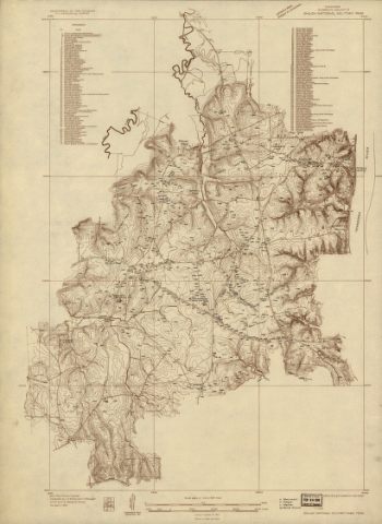
Shiloh National Military Park, Tenn.
$17.95 – $47.95 -
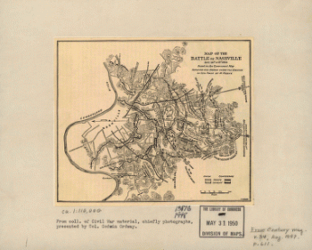
Map of the battle of Nashville
$17.95 – $47.95 -
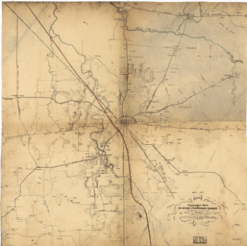
Topographical sketch of the environs of Murfreesboro, Tennessee
$17.95 – $47.95
![Knoxville, Tenn. county seat of Knox County 1886. [Drawn by] H. Wellge. Beck & Pauli, litho.](https://www.ushistoricalarchive.com/wp-content/uploads/nc/data/products/im/sm/tn/b77-350x246.gif)