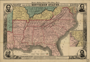
Including rail roads, county towns, state capitals, count roads, the southern coast from Delaware to Texas. Showing the harbors, inlets, forts and position of blockading ships. Bacon & Co. CREATED/PUBLISHED London, [1863?] NOTES Scale ca. 1:2,970,000. At top of map: Bacon's shilling series of war maps,-no. 3. Inset: Enlarged plan of the battle fields of Virginia and Maryland. Scale ca. 1:1,040,000. Includes portraits of Lincoln, Scott, Stonewall Jackson,and McClellan.


