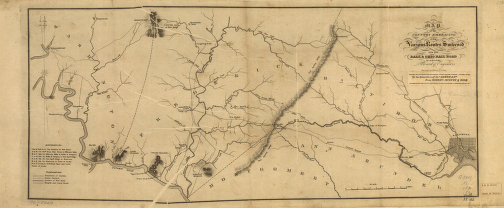
Map of the country embracing the various routes surveyed for the Balt. & Ohio Rail Road by order of the Board of Engineers. Drawn by Lt. J. Barney, U.S. Army. Map of Baltimore, Ann Arundel, Montgomery, Frederick, and Washington counties, Md, showing drainage, roads, and important place names. Barney, Joshua, 1799 or 1800-1867. CREATED/PUBLISHED [Baltimore? 1831?] Scale ca. 1:193,000.
Baltimore and Ohio Railroad Company
$17.95 – $47.95
SKU: rrac19
Related products
-

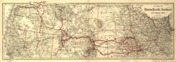
Union Pacific Railway Company
$17.95 – $47.95 -
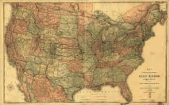
Union Pacific Railroad Company
$17.95 – $47.95 -
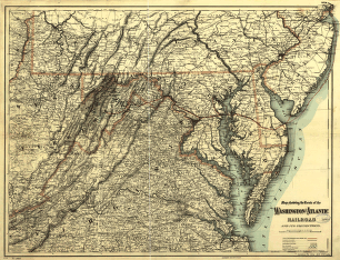
Washington and Atlantic Railroad
$17.95 – $47.95 -
Winchester and Potomac Railroad Company
$17.95 – $47.95