Home
All Products
Historic Maps
American Indian Maps
Birds Eye View Maps
Civil War Maps
Panoramic Maps
Railroad Maps
Revolutionary War Maps
State Maps
Historic Prints
Civil War Prints
Civil War Posters
Historic Portraits
Presidential Portraits
Contact Us
0
0
press
Enter
to search
Showing all results:
No products found.
Home
/
State Maps
/
New Jersey
/
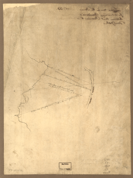
Lines run in the Jersies for determining boundaries between that Province & New York.
$
17.95
–
$
47.95
SKU: smnj29
Paper Size
Choose an option
12" x 18"
18" x 24"
24" x 36"
Clear
Quantity
Qty
Add to cart
Description
CREATED/PUBLISHED [1769?] NOTES Scale ca. 1:740,000.
SKU:
smnj29
Category:
New Jersey
Related products
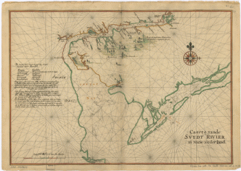
Caert vande Svydt Rivier in Niew Nederland.
$
17.95
–
$
47.95
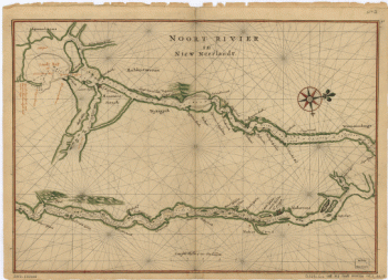
Noort Rivier in Niew Neerlandt.
$
17.95
–
$
47.95
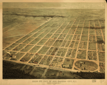
Birds eye view of Egg Harbor City, N.J. Herline & Hensel, lith.
$
17.95
–
$
47.95
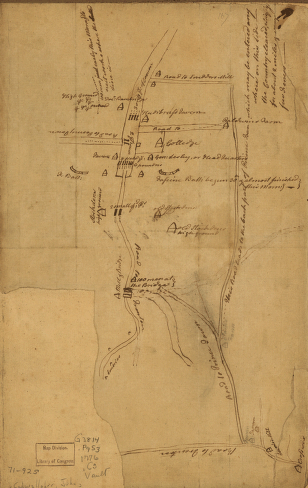
Plan of Princeton, Dec. 31, 1776.
$
17.95
–
$
47.95
Search Product or SKU
×
Home
All Products
Historic Maps
American Indian Maps
Birds Eye View Maps
Civil War Maps
Panoramic Maps
Railroad Maps
Revolutionary War Maps
State Maps
Historic Prints
Civil War Prints
Civil War Posters
Historic Portraits
Presidential Portraits
Contact Us
Cart
0
Cart
Close
Updating…
No products in the cart.
Continue shopping