Compiled and published by Nathan Hale, Boston, 1826.Hale, Nathan, 1784-1863. CREATED/PUBLISHED Boston, 1849. SUMMARY Detailed county and township map indicating drainage, relief by hachures, cities and towns, roads, railroads, and railroad stations. NOTES Scale [ca. 1:525,000]. Inset: Northern & eastern part of Maine and part of Lower Canada and New Brunswick.
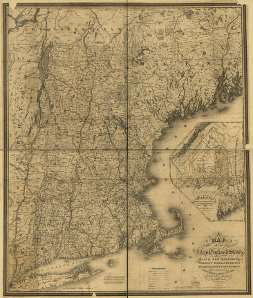
New England states, Maine, New Hampshire, Vermont, Massachusetts, Rhode Island & Connecticut with the adjacent parts of New York & Lower Canada
$17.95 – $47.95
SKU: smnh65
Related products
-

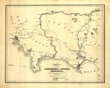
Portsmouth and Concord Railroad
$17.95 – $47.95 -
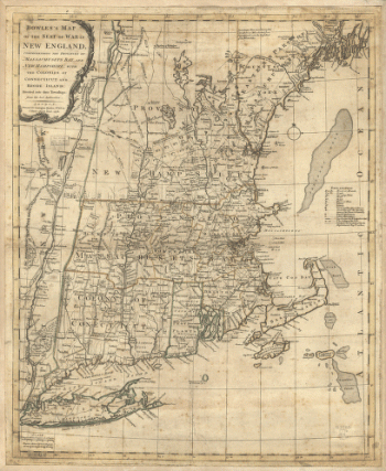
Bowles's map of the seat of war in New England
$17.95 – $47.95
![Bird's eye view of Whitefield, Coos County, N.H., 1883. [Drawn by] A. F. Poole. Beck & Pauli, lithographers.](https://www.ushistoricalarchive.com/wp-content/uploads/nc/data/products/im/sm/nh/b45-350x270.gif)