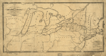
Maps of the expedition from Canada of Gen. Burgoyne
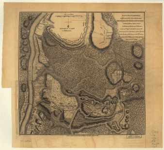
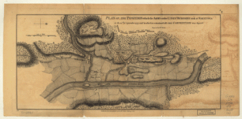
Plan of the encampment and position of the army under Lt. Gen. Burgoyne, at Braemus Heights, 8th Oct 1777
$17.95 – $47.95
SKU: smcan68
Related products
-

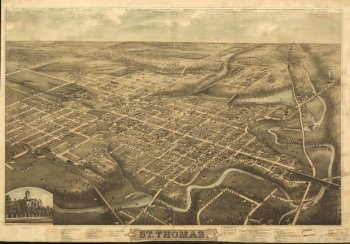
St. Thomas
$17.95 – $47.95 -
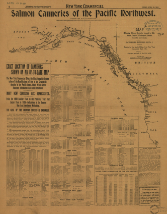
Salmon Canneries of the Pacific Northwest
$17.95 – $47.95