Home
All Products
Historic Maps
American Indian Maps
Birds Eye View Maps
Civil War Maps
Panoramic Maps
Railroad Maps
Revolutionary War Maps
State Maps
Historic Prints
Civil War Prints
Civil War Posters
Historic Portraits
Presidential Portraits
Contact Us
0
0
press
Enter
to search
Showing all results:
No products found.
Home
/
Revolutionary War Maps
/
South
/
Plat of a survey for William Hughes, Jr of 460 acres in Frederick County, Va on the Cacapon River
$
17.95
–
$
47.95
SKU: rwso67
Paper Size
Choose an option
12" x 18"
18" x 24"
24" x 36"
Clear
Quantity
Qty
Add to cart
Description
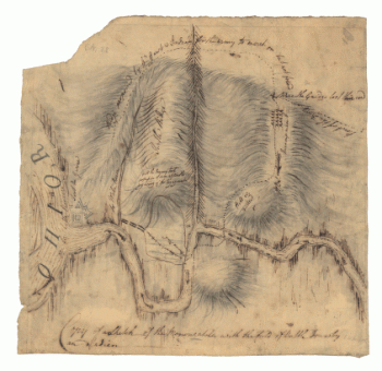
Washington, George, 1732-1799. CREATED/PUBLISHED 1750.
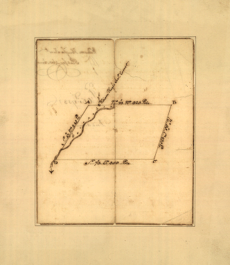
SKU:
rwso67
Category:
South
Related products
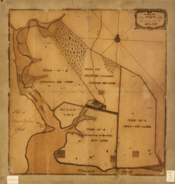
A plan of my farm on Little Huntg Creek & Potomk R G W
$
17.95
–
$
47.95
[Zehn Karten und Ansichten den Schlachtfelden des amerikanischen Unabhangigkeitskreiges in den Staaten Pennsylvanien und New York]
$
17.95
–
$
47.95
[Zehn Karten und Ansichten den Schlachtfelden des amerikanischen Unabhangigkeitskreiges in den Staaten Pennsylvanien und New York]
$
17.95
–
$
47.95
Copy of a sketch of the Monongahela, with the field of battle, done by an Indian
$
17.95
–
$
47.95
Search Product or SKU
×
Home
All Products
Historic Maps
American Indian Maps
Birds Eye View Maps
Civil War Maps
Panoramic Maps
Railroad Maps
Revolutionary War Maps
State Maps
Historic Prints
Civil War Prints
Civil War Posters
Historic Portraits
Presidential Portraits
Contact Us
Cart
0
Cart
Close
Updating…
No products in the cart.
Continue shopping