Drawn by Major Holland, Surveyor General, of the Northern District in America. Corrected and improved, from the original materials, by Governr. Pownall, Member of Parliament, 1776. Pownall, Thomas, 1722-1805. CREATED/PUBLISHED London, Robt. Sayer & John Bennett, 1776. NOTES Scale ca. 1:650,000. Relief shown pictorially. Shows administrative divisions. Insets: A chart of the mouth of Hudson's River, from Sandy Hook to New York.–A plan of the city of New York.–Plan of Amboy, with its environs, from an actual survey.
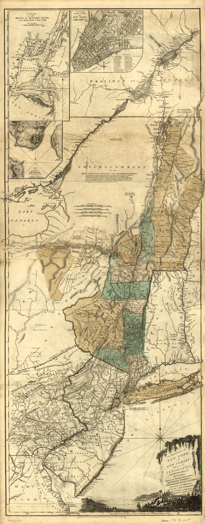
The provinces of New York and New Jersey; with part of Pensilvania, and the Province of Quebec
$17.95 – $47.95
SKU: smny17
Related products
-

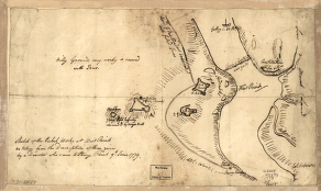
Sketch of the rebel works at West Point
$17.95 – $47.95 -
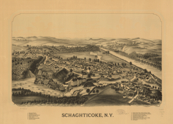
Schaghticoke, N.Y.
$17.95 – $47.95 -
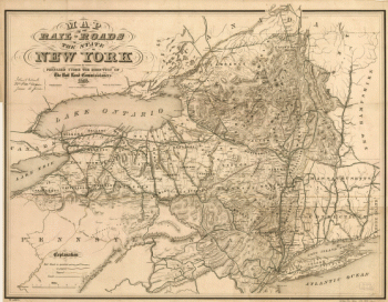
Map of the railroads of the state of New York
$17.95 – $47.95