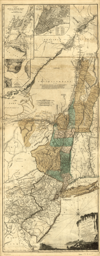
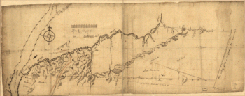
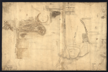
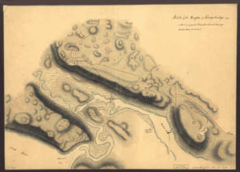
Home
All Products
Historic Maps
American Indian Maps
Birds Eye View Maps
Civil War Maps
Panoramic Maps
Railroad Maps
Revolutionary War Maps
State Maps
Historic Prints
Civil War Prints
Civil War Posters
Historic Portraits
Presidential Portraits
Contact Us
0
0
Search Product or SKU
×
press
Enter
to search
Showing all results:
No products found.
New York
Search
Search Product or SKU
×
Sort By
Default
Price: Low to High
Price: High to Low
Alphabetical
SKU
Categories
All
American Indian Maps
American Indian Photos
Birds Eye View Maps
CD Collections
Civil War Maps
Civil War Posters
Civil War Prints
Panoramic Maps
Photo-chromes
Presidential Portraits
Railroad Maps
Revolutionary War Maps
St. Augustine
State Maps
Alabama
California
Canada
Georgia
Louisiana
Michigan
New Hampshire
New Jersey
New York
New York City
North Carolina
Ohio
South Carolina
Tennessee
Texas
Washington DC
Showing
“New York”
Skecth [sic] of the road from Kings Bridge to White Plains.
$
17.95
–
$
47.95
A map of the provinces of New-York and New Jersey, with a part of Pennsylvania and the Province of Quebec
$
17.95
–
$
47.95
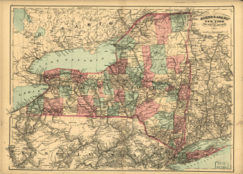
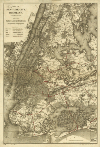
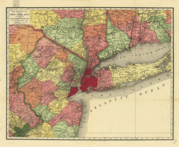
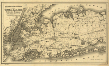
Asher & Adams' New York and part of Ontario.
$
17.95
–
$
47.95
Draft of the lands disputed by Philipse Patent against Beekmans & Rambaults.
$
17.95
–
$
47.95
Disposition of British troops, with fortifications north of Fort Knipehausen, i.e. Fort Washington to Fort Independence.
$
17.95
–
$
47.95
A Plan of the works on Spikendevil Hill with the ground in front, protracted from a scale of 200 feet to an inch
$
17.95
–
$
47.95
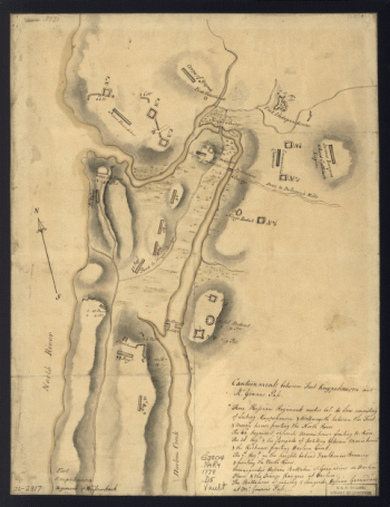
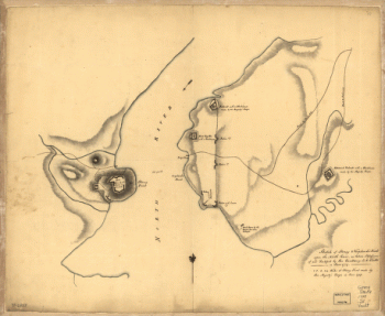
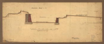
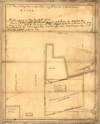
Sketch of Stoney & Verplank's Points upon the North River
$
17.95
–
$
47.95
Carte de l'entrée de la rivière d'Hudson, dépuis Sandy-Hook jusques à New-York avec les bancs, sondes, marques de navigation
$
17.95
–
$
47.95
Map of New York City, Brooklyn, and vicinity showing surface & elevated railroads in operation and proposed
$
17.95
–
$
47.95
The provinces of New York and New Jersey; with part of Pensilvania, and the Province of Quebec
$
17.95
–
$
47.95
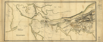
Nord de l'Ile de New-York.
$
17.95
–
$
47.95
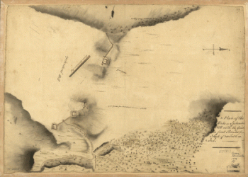
A plan of the Narrows of Hells-gate in the East River
$
17.95
–
$
47.95
Oyster Bay and Huntington. Huntington Bay.
$
17.95
–
$
47.95
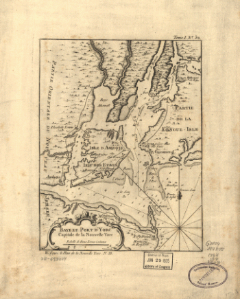
Baye et port d'Yorc, capitale de la Nouvelle Yorc.
$
17.95
–
$
47.95
Rand, McNally & Co.'s map of New York city and vicinity showing steam railroads and electric lines.
$
17.95
–
$
47.95
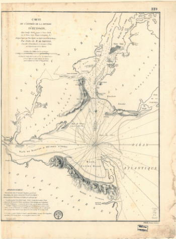
Environs de New-York, de Long-Island, etc.
$
17.95
–
$
47.95
Map showing the Bowery Lane area of Manhattan.
$
17.95
–
$
47.95
Position du camp de l'armée combinée a Philipsburg du 6 juillet au 19 aoust.
$
17.95
–
$
47.95
Designs for fortifying Governors Island near New York.
$
17.95
–
$
47.95
Sketch of the Heights of Kingsbridge 1777, with the proposed redoubts coloured orange
$
17.95
–
$
47.95
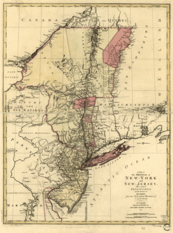
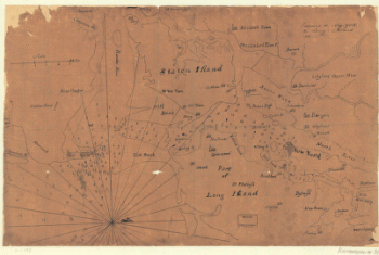
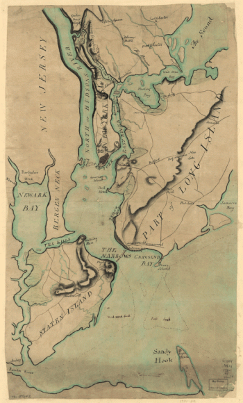
Plan of New York and Staten Islands with part of Long Island.
$
17.95
–
$
47.95
Map showing the route & connections of the Central Rail Road Extension Company of Long Island.
$
17.95
–
$
47.95
A plan of St. Georges Ferry on Nassau-Island made the 10th August 1774, by G. Bancker, city surveyor.
$
17.95
–
$
47.95
Manatvs gelegen op de Noot [sic] Riuier.
$
17.95
–
$
47.95
1
2
Load More
All products loaded.
Search Product or SKU
×
Home
All Products
Historic Maps
American Indian Maps
Birds Eye View Maps
Civil War Maps
Panoramic Maps
Railroad Maps
Revolutionary War Maps
State Maps
Historic Prints
Civil War Prints
Civil War Posters
Historic Portraits
Presidential Portraits
Contact Us
Cart
0
Cart
Close
Updating…
No products in the cart.
Continue shopping