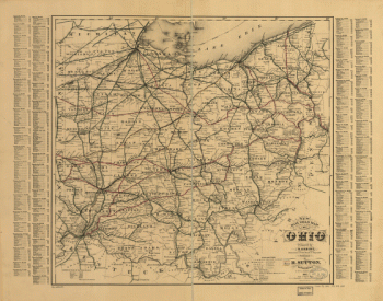
Home
All Products
Historic Maps
American Indian Maps
Birds Eye View Maps
Civil War Maps
Panoramic Maps
Railroad Maps
Revolutionary War Maps
State Maps
Historic Prints
Civil War Prints
Civil War Posters
Historic Portraits
Presidential Portraits
Contact Us
0
0
Search Product or SKU
×
press
Enter
to search
Showing all results:
No products found.
Ohio
Search
Search Product or SKU
×
Sort By
Default
Price: Low to High
Price: High to Low
Alphabetical
SKU
Categories
All
American Indian Maps
American Indian Photos
Birds Eye View Maps
CD Collections
Civil War Maps
Civil War Posters
Civil War Prints
Panoramic Maps
Photo-chromes
Presidential Portraits
Railroad Maps
Revolutionary War Maps
St. Augustine
State Maps
Alabama
California
Canada
Georgia
Louisiana
Michigan
New Hampshire
New Jersey
New York
New York City
North Carolina
Ohio
South Carolina
Tennessee
Texas
Washington DC
Showing
“Ohio”
A plan of the section of land on which the Believers live in the state of Ohio, Nov. 7th, 1807.
$
17.95
–
$
47.95
Bird's eye view of Bellaire, Ohio 1882. H. Wellge, del. Beck & Pauli, lithographers.
$
17.95
–
$
47.95
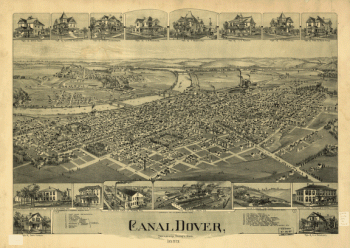
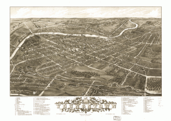
Canal Dover, Tuscarawas County, Ohio 1899. Drawn by A. E. Downs.
$
17.95
–
$
47.95
Bird's eye view of Camp Chase near Columbus, Ohio. Drawn by A. Ruger.
$
17.95
–
$
47.95
Panoramic view of the city of Youngstown, county seat of Mahoning Co., Ohio 1882
$
17.95
–
$
47.95
Map of rail road line between Loveland and Cincinnati; Marietta and Cincinnati Rail Road.
$
17.95
–
$
47.95
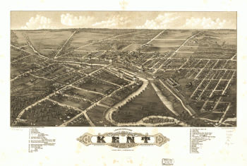
Panoramic view of the city of Kent, Portage County, Ohio 1882.
$
17.95
–
$
47.95
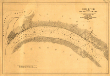
Ohio River between Mound City and Cairo
$
17.95
–
$
47.95
Plat of a survey of 2,314 acres of land, being the first large bottom on the east side of the Ohio River
$
17.95
–
$
47.95
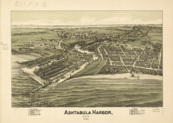
Ashtabula Harbor, Ohio 1896.
$
17.95
–
$
47.95
Camp Dennison : taken from Old Aunt Roady's Hill / drawn by Johnson in the Zouave Lt. Guard, Company A.
$
17.95
–
$
47.95
Map showing the military defences of Cincinnati, Covington and Newport
$
17.95
–
$
47.95
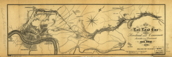
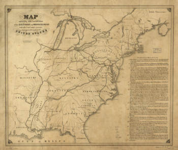
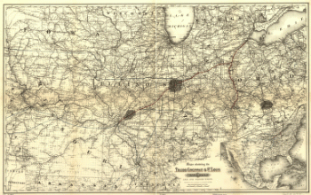
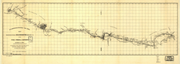
Connection of the Baltimore and Ohio rail road
$
17.95
–
$
47.95
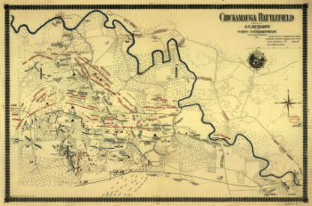
Chickamauga battlefield
$
17.95
–
$
47.95
Partie de l'Amérique septentrionale, qui comprend le cours de l'Ohio, la Nlle. Angleterre, la Nlle York, le New Jersey, la Pensylvanie, le Maryland, la Virginie, la Caroline
$
17.95
–
$
47.95
man's rail road map of Ohio, Indiana, Michigan, Illinois, Missouri, Minnesota, & Wisconsin.
$
17.95
–
$
47.95
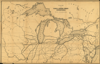
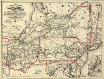
View of the lake & north west-connections with Philadelphia.
$
17.95
–
$
47.95
New rail road map of Ohio prepared by H. Sabine, Commissioner of Rail Roads & Telegraphs.
$
17.95
–
$
47.95
An accurate map of the British colonies in North America bordering on the river Ohio.
$
17.95
–
$
47.95
Guide through Ohio, Michigan, Indiana, Illinois, Missouri, Wisconsin & Iowa; by J. Calvin Smith, engraved by S. Stiles, Sherman & Smith.
$
17.95
–
$
47.95
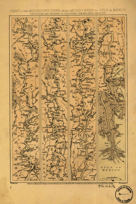
Mississippi River from the Ohio River to Gulf of Mexico
$
17.95
–
$
47.95
Maps showing the Toledo, Cincinnati, & St. Louis Railroad and its connections, 1881.
$
17.95
–
$
47.95
New York, New Jersey, Pennsylvania, Delaware, Maryland, Ohio and Canada, with parts of adjoining states.
$
17.95
–
$
47.95
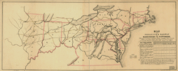
Map of the projected railway from Harrisburg to Pittsburg
$
17.95
–
$
47.95
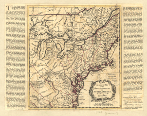
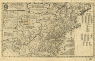
A map of the middle British colonies in North America
$
17.95
–
$
47.95
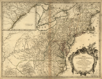
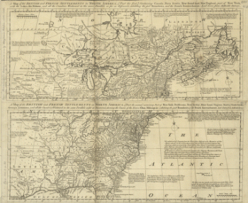
A map of the British and French settlements in North America
$
17.95
–
$
47.95
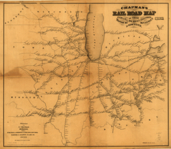
Hillsborough & Cincinnati Rail-road map
$
17.95
–
$
47.95
1
2
Load More
All products loaded.
Search Product or SKU
×
Home
All Products
Historic Maps
American Indian Maps
Birds Eye View Maps
Civil War Maps
Panoramic Maps
Railroad Maps
Revolutionary War Maps
State Maps
Historic Prints
Civil War Prints
Civil War Posters
Historic Portraits
Presidential Portraits
Contact Us
Cart
0
Cart
Close
Updating…
No products in the cart.
Continue shopping