State Maps
-

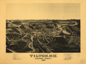
Tilton, N.H., Belknap County, 1884. H. Wellge, del.
$17.95 – $47.95 -
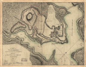
Ticonderoga
$17.95 – $47.95 -
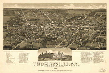
Thomasville, Ga. county-seat of Thomas-County 1885
$17.95 – $47.95 -
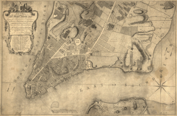
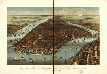
This plan of the city of New York
$17.95 – $47.95 -
This plan of the city of New York
$17.95 – $47.95 -
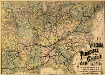
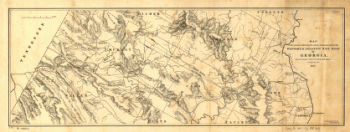
The Virginia, Tennessee, and Georgia Air Line
$17.95 – $47.95 -
The Virginia, Tennessee, and Georgia Air Line
$17.95 – $47.95 -
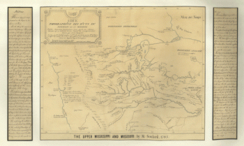
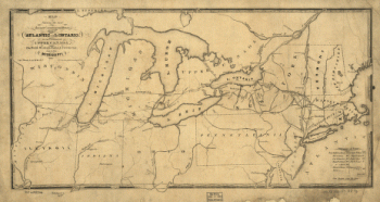
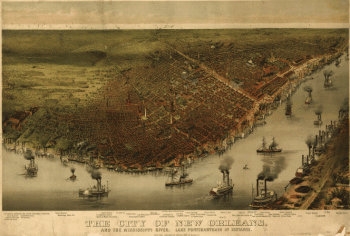
The upper Mississippi and Missouri
$17.95 – $47.95 -
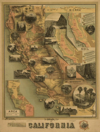
The unique map of California.
$17.95 – $47.95 -
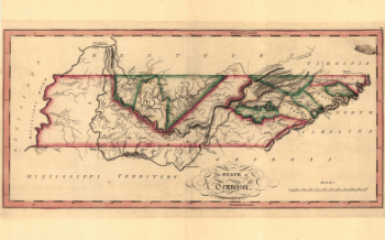
The state of Tennessee
$17.95 – $47.95 -
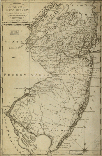
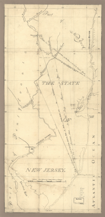
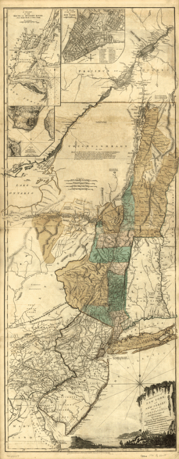
The State of New Jersey
$17.95 – $47.95 -
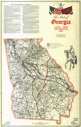
The State of Georgia, Civil War Centennial, 1864
$17.95 – $47.95 -
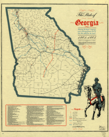
The State of Georgia
$17.95 – $47.95 -
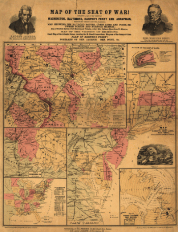
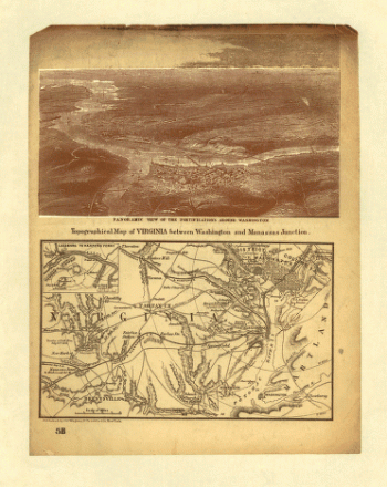
The Seat of War
$17.95 – $47.95 -
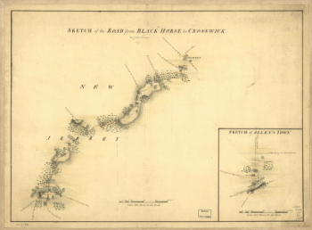
The road from Black Horse to Crosswick and Allen's Town
$17.95 – $47.95 -
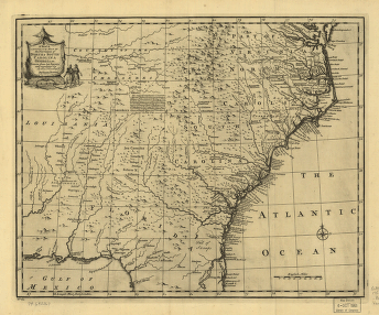
The provinces of North & South Carolina, Georgia
$17.95 – $47.95 -
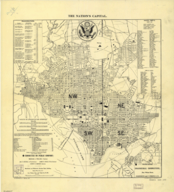
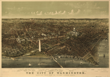
The nation's capital : Washington D.C.
$17.95 – $47.95 -
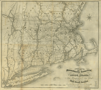
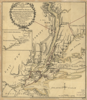
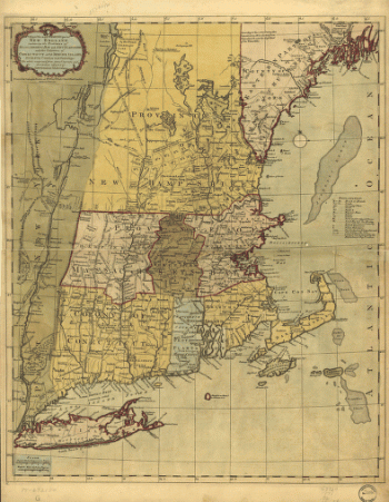
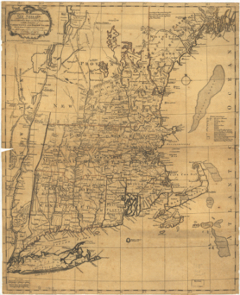
The most inhabited part of New England
$17.95 – $47.95 -
The most inhabited part of New England
$17.95 – $47.95 -
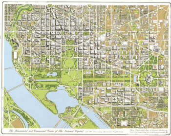
The monumental and commercial center of the national capital
$17.95 – $47.95 -
The Merchants' Association hotel and theater map.
$17.95 – $47.95 -
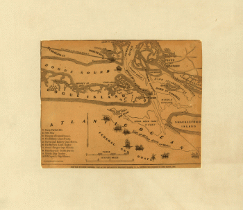
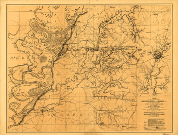
The environs of Savannah, Georgia
$17.95 – $47.95 -
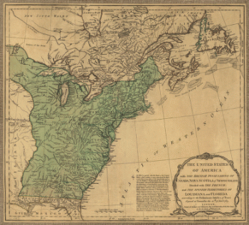
The English empire in North America
$17.95 – $47.95 -
The country between Millikens Bend, La. and Jackson, Miss.
$17.95 – $47.95 -
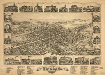
The city of Vineland, New Jersey, 1885.
$17.95 – $47.95 -
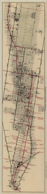
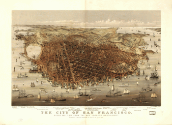
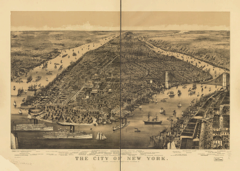
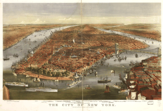
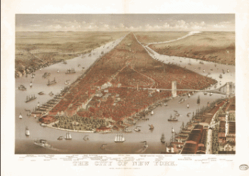
The city of New York
$17.95 – $47.95 -
The city of New York
$17.95 – $47.95 -
The city of New York
$17.95 – $47.95 -
The city of New York
$17.95 – $47.95 -
The city of New York
$17.95 – $47.95
![Topographic map of West Point, Constitution Island, and vicinity, N.Y.] / T.B.J. Weld.](https://www.ushistoricalarchive.com/wp-content/uploads/nc/data/products/im/sm/ny/b83-350x414.gif)
![Toledo, Ohio 1876. [By] A. Ruger. Chas. Shober & Co. props. Chicago Lith. Co.](https://www.ushistoricalarchive.com/wp-content/uploads/nc/data/products/im/sm/oh/b48-350x202.gif)