State Maps
-

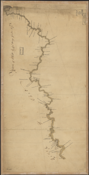
Sketch of Haddonfield
$17.95 – $47.95 -
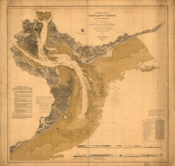
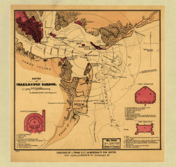
Sketch of Charleston Harbor By W. A. Williams, Civil Engineer.
$17.95 – $47.95 -
Skeleton map
$17.95 – $47.95 -
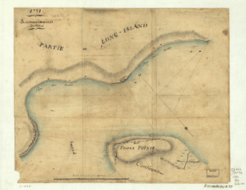
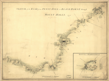
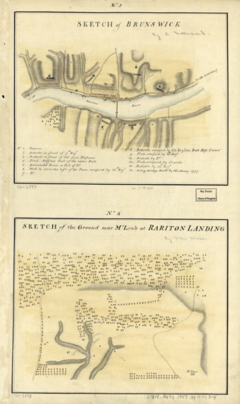
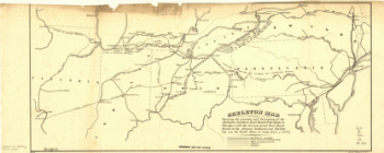
Skecth [sic] of the road from Kings Bridge to White Plains.
$17.95 – $47.95 -
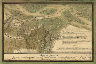
Siège de Savannah
$17.95 – $47.95 -
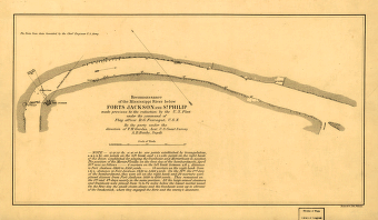
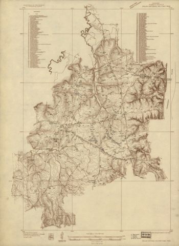
Shiloh National Military Park, Tenn.
$17.95 – $47.95 -
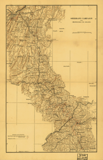
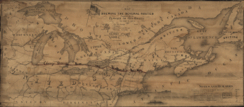
Sherman's campaign from Chattanooga to Atlanta from 1864
$17.95 – $47.95 -
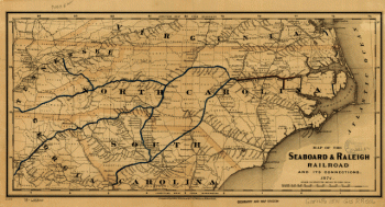
Seaboard & Raleigh Railroad and its connections
$17.95 – $47.95 -
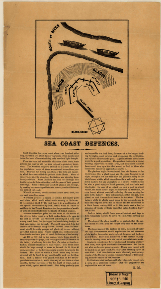
Sea coast defences
$17.95 – $47.95 -
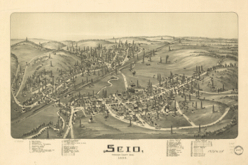
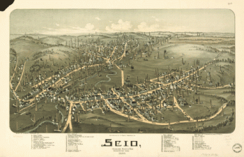
Scio, Harrison County, Ohio 1899
$17.95 – $47.95 -
Scio, Harrison County, Ohio
$17.95 – $47.95 -
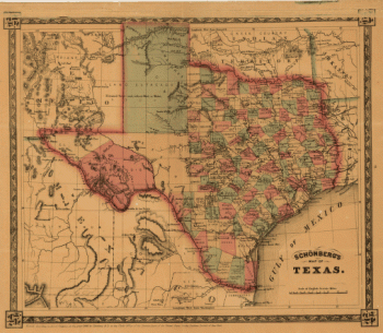
Schönberg's map of Texas.
$17.95 – $47.95 -
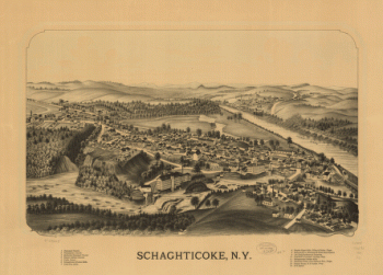
Schaghticoke, N.Y.
$17.95 – $47.95 -
Savannah and its environs.
$17.95 – $47.95 -
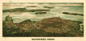
Sandusky, Ohio. Gugler Litho. Co.
$17.95 – $47.95 -
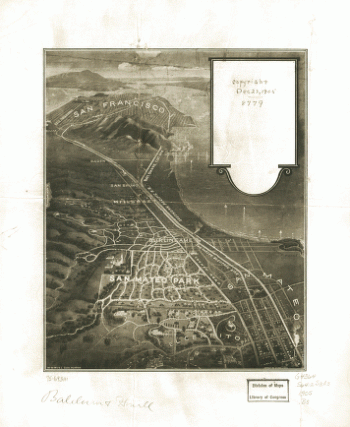
San Mateo Park.
$17.95 – $47.95 -
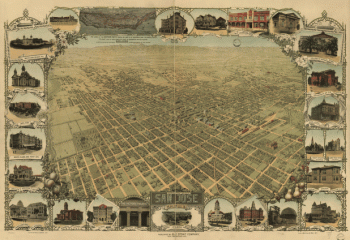
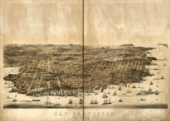
San Francisco.
$17.95 – $47.95 -
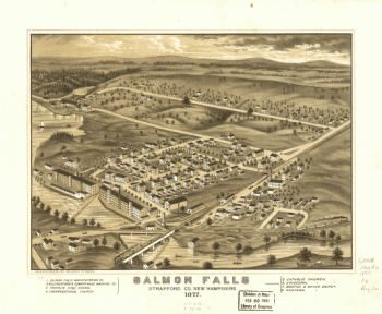
Salmon Falls, Strafford Co., New Hampshire 1877.
$17.95 – $47.95 -
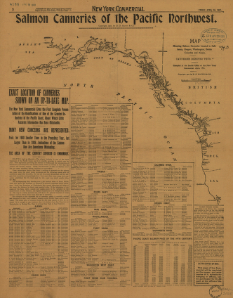
Salmon Canneries of the Pacific Northwest
$17.95 – $47.95 -
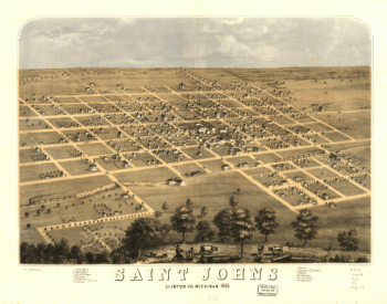
Saint Johns, Clinton Co., Michigan 1868. Drawn by A. Ruger.
$17.95 – $47.95 -
Saginaw City [Michigan 1867] Drawn from nature by A. Ruger.
$17.95 – $47.95 -
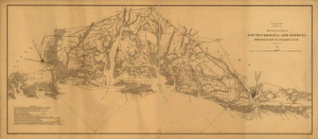
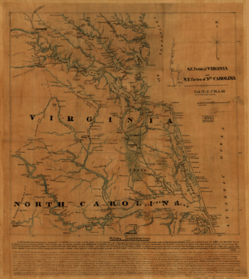
S.E. portion of Virginia and N.E. portion of N'th Carolina
$17.95 – $47.95 -
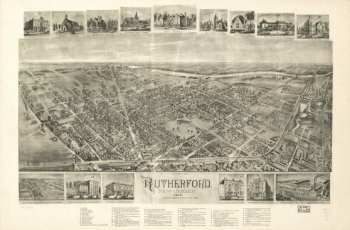
Rutherford, New Jersey 1904.
$17.95 – $47.95 -
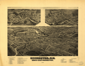
Rochester, N.H., Gonic and East-Rochester, 1884. H. Wellge, del.
$17.95 – $47.95 -
River of Ohio.
$17.95 – $47.95 -
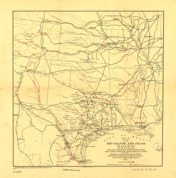
Rio Grande and Pecos Railway
$17.95 – $47.95 -
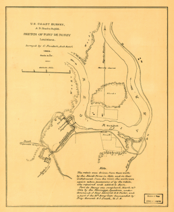
Resurvey of Charleston Bar
$17.95 – $47.95 -
Reconnoissance, juillet, 1781.
$17.95 – $47.95
![Skecth [sic] of the road from Kings Bridge to White Plains.](https://www.ushistoricalarchive.com/wp-content/uploads/nc/data/products/im/sm/ny/b29-350x507.gif)
![Saginaw City [Michigan 1867] Drawn from nature by A. Ruger.](https://www.ushistoricalarchive.com/wp-content/uploads/nc/data/products/im/sm/mi/b22-350x275.gif)
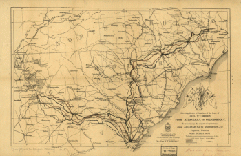
![Route of marches of the army of Genl. W. T. Sherman, from Atlanta, Ga. to Goldsboro, N.C. [1861-65]](https://www.ushistoricalarchive.com/wp-content/uploads/nc/data/products/im/sm/sc/b65-350x226.gif)
![Rough plan of part of battle of Wauhatchie, Tenn., night of Oct. 28-29, 1863 Drawn from memory by H. T. [i.e., Hector Tyndale. 188-].](https://www.ushistoricalarchive.com/wp-content/uploads/nc/data/products/im/sm/tn/b63-350x241.gif)