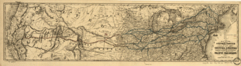
A geographically correct county map of the states traversed by the Atchison Topeka and the Santa Fé Railroad and its connections. Detailed map of the central United States showing relief by hachures, drainage, counties, cities and towns, roads, wagon trails, and the railroad network. This line was chartered by the state of Kansas in 1859; the first 75 miles of line were not completed until 1871. Woodward, Tiernan, and Hale. CREATED/PUBLISHED St. Louis, [1880] Scale ca. 1:2,750,000.

Atchison, Topeka, and Santa Fe Railroad Company
$17.95 – $47.95
SKU: rrac7
Related products
-

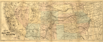
Union Pacific Railroad Company
$17.95 – $47.95 -
Virginia Central Railroad Company
$17.95 – $47.95 -
Union Pacific Railroad Company
$17.95 – $47.95 -
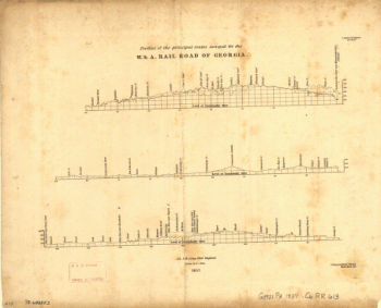
Western and Atlantic Railroad Company
$17.95 – $47.95