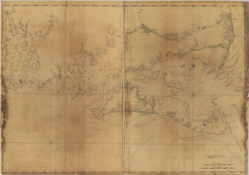
Montresor, John, 1736-1799. CREATED/PUBLISHED [1761?] NOTES Scale ca. 1:390,000. Relief shown pictorially. Shows campsite locations for the author's expedition from Quebec into Maine.

A map of the sources of the Chaudière, Penobscot, and Kennebec rivers, by Montresore
$17.95 – $47.95
SKU: rwne27
Related products
-

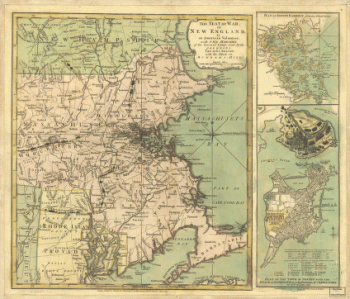
Coast of New England from Chatham Harbor to Narragansett Bay
$17.95 – $47.95 -
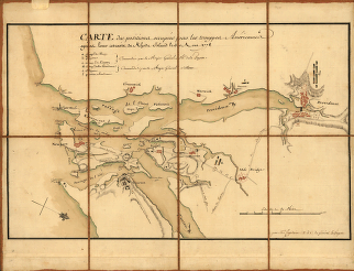
Marche de l'armee francaise de Providence a la Rivière du Nord
$17.95 – $47.95