Home
All Products
Historic Maps
American Indian Maps
Birds Eye View Maps
Civil War Maps
Panoramic Maps
Railroad Maps
Revolutionary War Maps
State Maps
Historic Prints
Civil War Prints
Civil War Posters
Historic Portraits
Presidential Portraits
Contact Us
0
0
press
Enter
to search
Showing all results:
No products found.
Search
Search Product or SKU
×
Sort By
Default
Price: Low to High
Price: High to Low
Alphabetical
SKU
Categories
All
American Indian Maps
American Indian Photos
Birds Eye View Maps
CD Collections
Civil War Maps
Civil War Posters
Civil War Prints
Panoramic Maps
Photo-chromes
Presidential Portraits
Railroad Maps
Revolutionary War Maps
St. Augustine
State Maps
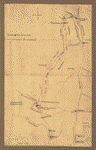
Plan of Carillon ou Ticonderoga
$
17.95
–
$
47.95
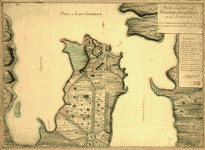
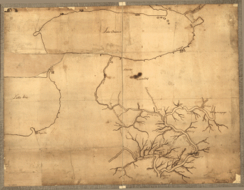
Plan of the fort and fortress at Crown Point with their environs
$
17.95
–
$
47.95
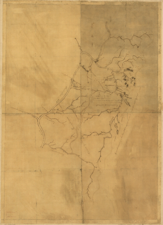
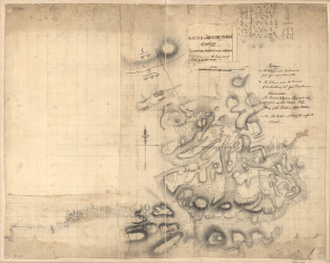
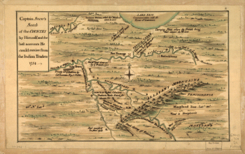
Plan of the attack on Fort William Henry and Ticonderoga
$
17.95
–
$
47.95
Carte de la Florida, de la Louisiane, et pays voisins : pour servir a l'Histoire generale des voyages / par M B, ing de la marine, 1757
$
17.95
–
$
47.95
A map with part of the Florida coast from Cape Blaise to Apalachie, with the boundaries betwixt East & West Floridas, 160 yards across the river call'd Apalachicola Robt Slowley of Hs Ms sloop Druid, fecit September the 4th, 1769
$
17.95
–
$
47.95
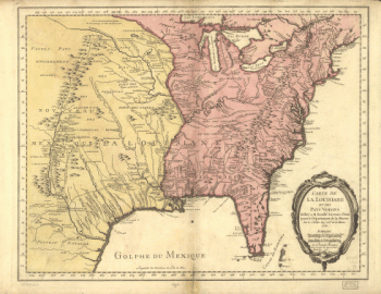
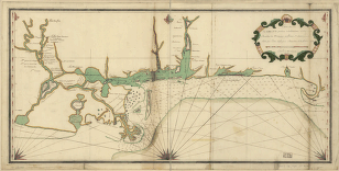
Map of West Florida B Romans, inv delin & in AEre incidit
$
17.95
–
$
47.95
A plan of the inlets & rivers of Savannah & Warsaw in the Province of Georgia
$
17.95
–
$
47.95
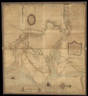
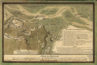
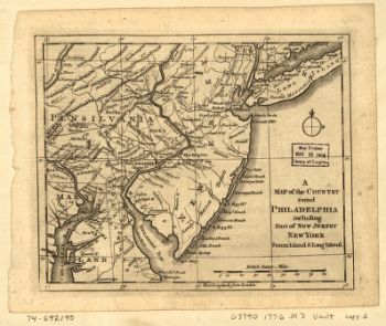
Savannah and its environs
$
17.95
–
$
47.95
Siège de Savannah fait par les troupes francoises aux ordres du general d'Estaing vice-amiral de France, en 7bre, et 8bre 1779
$
17.95
–
$
47.95
A map of Canada and the north part of Louisiana with the adjacent countrys By Thos Jefferys, geographer to His Majesty, 1762
$
17.95
–
$
47.95
A map of Canada and the north part of Louisiana with the adjacent countrys By Thos Jefferys, geographer to His Majesty, 1762
$
17.95
–
$
47.95
Carte de la Louisiane et des pays voisins dediee a M Rouille secretaire d'etat, ayant le Departement de la marine Par le Sr Bellin ingr ordre de la marine, 1750
$
17.95
–
$
47.95
Canada et Louisiane, par le Sr le Rouge ingenieur geographe du Roy
$
17.95
–
$
47.95
Carte de la Louisiane et des pays voisins, dediee a M Rouille, secretaire d'etat, ayant le Departement de la marine Par le Sr Bellin, ingr ordre de la marine, 1750
$
17.95
–
$
47.95
Carte du Canada et de la Louisiane qui forment la Nouvelle France et des colonies angloises ou sont representez les pays contestez
$
17.95
–
$
47.95
Carte de la Louisiane et pays voisins, pour servir a l'Histoire generale des voyages Par M B, ing de la marine
$
17.95
–
$
47.95
Carte de la Louisiane et des pays voisins dediee a M Rouille secretaire d'etat, ayant le Departement de la marine Par le Sr Bellin ingr ordre de la marine, 1750
$
17.95
–
$
47.95
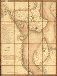
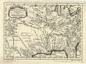
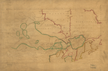
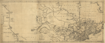
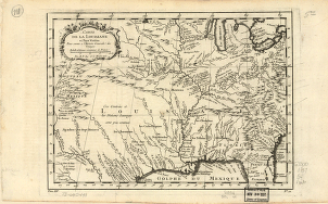
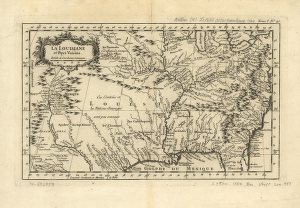
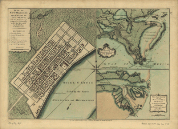
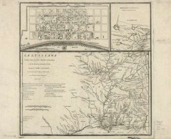
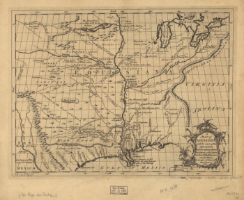
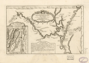
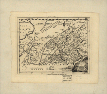
La Louisiane et pays voisins
$
17.95
–
$
47.95
Carte des possessions francoises et angloises dans le Canada, et partie de la Louisiane, 1756 L Thevenard fil sculp
$
17.95
–
$
47.95
Carte de la coste de la province de la Louisiane et des bouches du Micissipy ou fleuve St Louis, faite par Jean Lefargue, Bayonne, le 20 fevrier, 1768
$
17.95
–
$
47.95
Plan of New Orleans the capital of Louisiana, with the disposition of its quarters and canals as they have been traced by Mr de la Tour in the year 1720
$
17.95
–
$
47.95
La Luisiana cedida al Rei N S por S M Christianisima, con la Nueva Orleans, è isla en que se halla esta ciudad Construida sobre el mapa de Mr d'Anville Por D Thomás Lopez
$
17.95
–
$
47.95
A plan of the harbour of Pensacola in West-Florida Surveyed in the year 1764 by George Gauld, MA The bar by Sir John Lindsay
$
17.95
–
$
47.95
A map of Louisiana, with the course of the Missisipi, and the adjacent rivers, the nations of the natives, the French establishments and the mines, by the author of ye History of that colony 1757
$
17.95
–
$
47.95
Suite du cours du fleuve St Louis depuis la rivière d'Iberville jusq'a celle des Yasous, et les parties connues de la Rivière Rouge et la Rivière Noire
$
17.95
–
$
47.95
A Map of the country round Philadelphia including part of New Jersey, New York, Staten Island, & Long Island
$
17.95
–
$
47.95
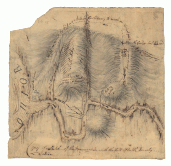
Battle of Brandywine, 11 Septr 1777
$
17.95
–
$
47.95
Battle of Brandywine, 11th Septr 1777, in which the rebels were defeated by the Army under the command of Genl Sir Willm Howe
$
17.95
–
$
47.95
A plan of the city and environs of Philadelphia, survey'd by N Scull and G Heap Engraved by Will Faden
$
17.95
–
$
47.95
A map of Philadelphia and parts adjacent : with a perspective view of the State-House / by N Scull and G Heap , L Hebert sculpt
$
17.95
–
$
47.95
Copy of a sketch of the Monongahela, with the field of battle, done by an Indian
$
17.95
–
$
47.95
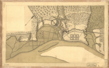
Plan of part of western front
$
17.95
–
$
47.95
British camp at Trudruffrin from [sic] with the attack made by Major General Grey against the rebels near White Horse Tavern
$
17.95
–
$
47.95
Captain Snow's scetch of the country by himself, and the best accounts he could receive from the Indian traders
$
17.95
–
$
47.95
A map of the province of Pensilvania / drawn from the best authorities by T Kitchin gr
$
17.95
–
$
47.95
[Zehn Karten und Ansichten den Schlachtfelden des amerikanischen Unabhangigkeitskreiges in den Staaten Pennsylvanien und New York]
$
17.95
–
$
47.95
[Zehn Karten und Ansichten den Schlachtfelden des amerikanischen Unabhangigkeitskreiges in den Staaten Pennsylvanien und New York]
$
17.95
–
$
47.95
[Zehn Karten und Ansichten den Schlachtfelden des amerikanischen Unabhangigkeitskreiges in den Staaten Pennsylvanien und New York]
$
17.95
–
$
47.95
[Zehn Karten und Ansichten den Schlachtfelden des amerikanischen Unabhangigkeitskreiges in den Staaten Pennsylvanien und New York]
$
17.95
–
$
47.95
[Zehn Karten und Ansichten den Schlachtfelden des amerikanischen Unabhangigkeitskreiges in den Staaten Pennsylvanien und New York]
$
17.95
–
$
47.95
[Zehn Karten und Ansichten den Schlachtfelden des amerikanischen Unabhangigkeitskreiges in den Staaten Pennsylvanien und New York]
$
17.95
–
$
47.95
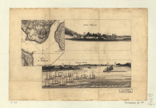
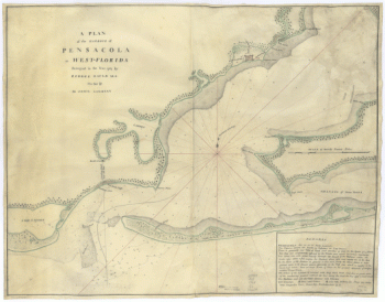
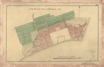
A Plan of the town of Pensacola, 1767
$
17.95
–
$
47.95
[Zehn Karten und Ansichten den Schlachtfelden des amerikanischen Unabhangigkeitskreiges in den Staaten Pennsylvanien und New York]
$
17.95
–
$
47.95
[Zehn Karten und Ansichten den Schlachtfelden des amerikanischen Unabhangigkeitskreiges in den Staaten Pennsylvanien und New York]
$
17.95
–
$
47.95
[Zehn Karten und Ansichten den Schlachtfelden des amerikanischen Unabhangigkeitskreiges in den Staaten Pennsylvanien und New York]
$
17.95
–
$
47.95
[Zehn Karten und Ansichten den Schlachtfelden des amerikanischen Unabhangigkeitskreiges in den Staaten Pennsylvanien und New York]
$
17.95
–
$
47.95
A map of the land abt Red Stone and Fort Pitt, given to me by Cap Crawfd
$
17.95
–
$
47.95
Plan d'Amboy Vues de la rade de Charles-Town et de Fort Sulivan, mai 1780
$
17.95
–
$
47.95
1
2
3
…
184
185
186
187
188
189
190
…
206
207
208
Load More
All products loaded.
Search Product or SKU
×
Home
All Products
Historic Maps
American Indian Maps
Birds Eye View Maps
Civil War Maps
Panoramic Maps
Railroad Maps
Revolutionary War Maps
State Maps
Historic Prints
Civil War Prints
Civil War Posters
Historic Portraits
Presidential Portraits
Contact Us
Cart
0
Cart
Close
Updating…
No products in the cart.
Continue shopping