-

US Railroad Lines P-R
$19.95 -
US Railroad Lines S-Z
$19.95 -
Alabama
$19.95 -
California
$19.95 -
Georgia
$19.95 -
Louisiana
$19.95 -
Michigan
$19.95 -
New Hampshire
$19.95 -
New Jersey
$19.95 -
New York
$19.95 -
New York City
$19.95 -
North Carolina
$19.95 -
Ohio
$19.95 -
South Carolina
$19.95 -
Tennessee
$19.95 -
Texas
$19.95 -
Washington DC
$19.95 -
Canada Map Collection
$19.95 -

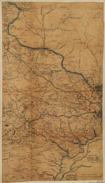
Fairfax County, and parts of Loudoun and Prince William Counties
$17.95 – $47.95 -
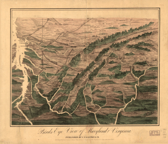
Birds eye view of Maryland and Virginia
$17.95 – $47.95 -
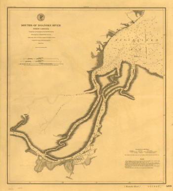
Mouths of Roanoke River, North Carolina
$17.95 – $47.95 -
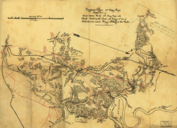
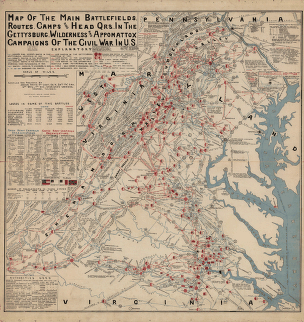
The main battlefields, routes, camps and head quarters
$17.95 – $47.95 -
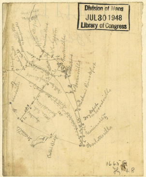
Sketch of parts of Albemarle and Nelson counties, Virginia
$17.95 – $47.95 -
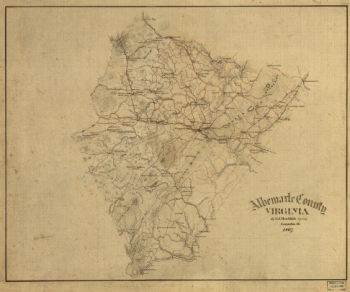
Albemarle County, Virginia
$17.95 – $47.95 -
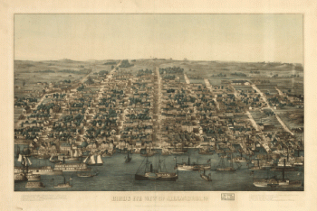
Birds eye view of Alexandria, Va.
$17.95 – $47.95 -
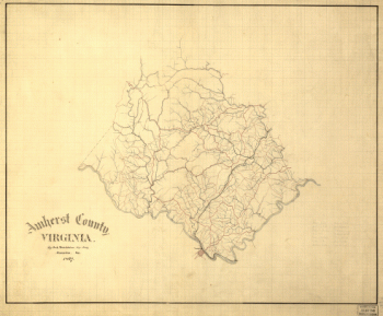
Amherst County, Virginia
$17.95 – $47.95 -
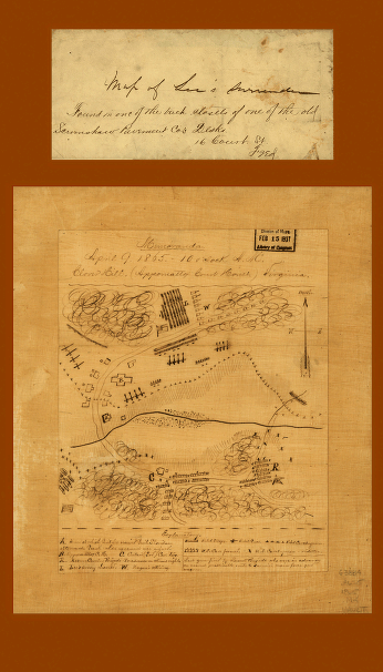
Clover Hill (Appomattox Court House) Virginia
$17.95 – $47.95 -
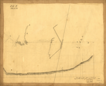
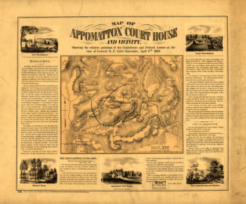
Map of Appomattox Court House and vicinity
$17.95 – $47.95 -
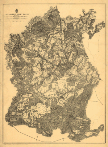
Appomattox Court House
$17.95 – $47.95 -
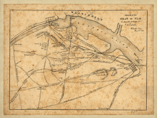
Sketch of the seat of war in Alexandria & Fairfax Counties
$17.95 – $47.95 -
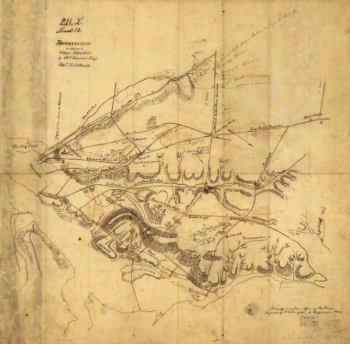
Reconnaissance in advance of Camp Mansfield
$17.95 – $47.95 -
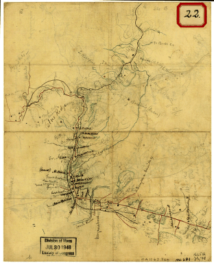
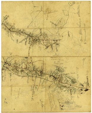
Sketch of the road from Waynesboro toward Staunton – Map 1
$17.95 – $47.95 -
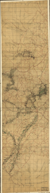
Sketch of the road from Waynesboro toward Staunton – Map 2
$17.95 – $47.95 -
Augusta County, Va
$17.95 – $47.95 -
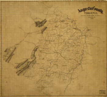
Augusta County, Virginia
$17.95 – $47.95 -
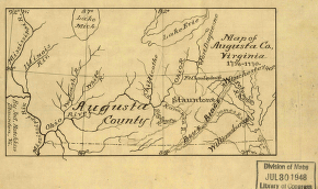
Map of Augusta Co., Virginia, 1738-1770
$17.95 – $47.95 -
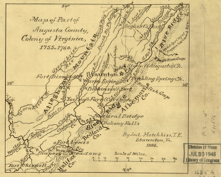
Part of Augusta County, Colony of Virginia
$17.95 – $47.95