-

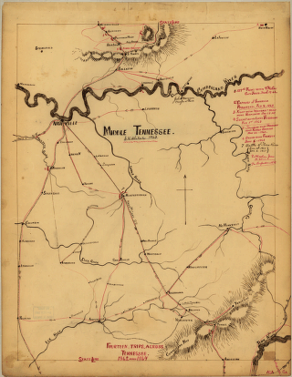
Middle Tennessee
$17.95 – $47.95 -
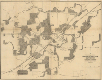
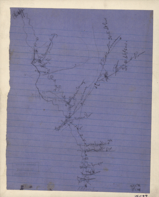
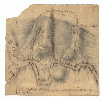
Topographical sketch of the battlefield of Stone's River
$17.95 – $47.95 -
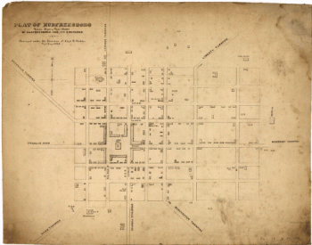
Murfreesboro
$17.95 – $47.95 -
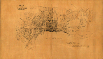
Nashville, Tennessee
$17.95 – $47.95 -
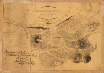
Topographical map of Nashville, Tenn.
$17.95 – $47.95 -
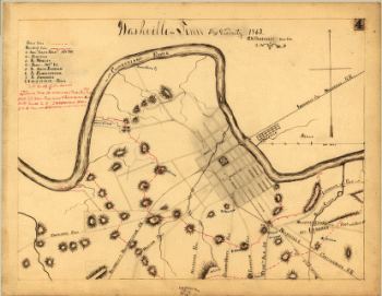
Nashville and vicinity in 1863
$17.95 – $47.95 -
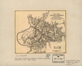
The battle of Nashville
$17.95 – $47.95 -
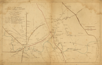
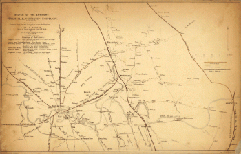
The environs of Shelbyville, Wartrace & Normandy, Tennessee
$17.95 – $47.95 -
The environs of Shelbyville, Wartrace & Normandy
$17.95 – $47.95 -
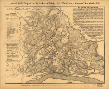
General Buell's map of the battle-field of Shiloh
$17.95 – $47.95 -
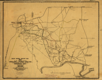
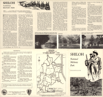
Shiloh National Military Park, Tenn.
$17.95 – $47.95 -
Shiloh National Military Park
$17.95 – $47.95 -
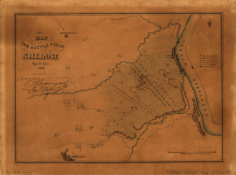
Map of the battle field of Shiloh
$17.95 – $47.95 -
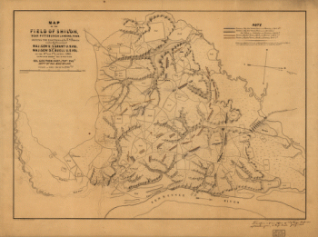
The field of Shiloh, near Pittsburgh Landing, Tenn.
$17.95 – $47.95 -
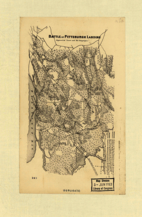
Battle of Pittsburgh Landing – Shiloh
$17.95 – $47.95 -
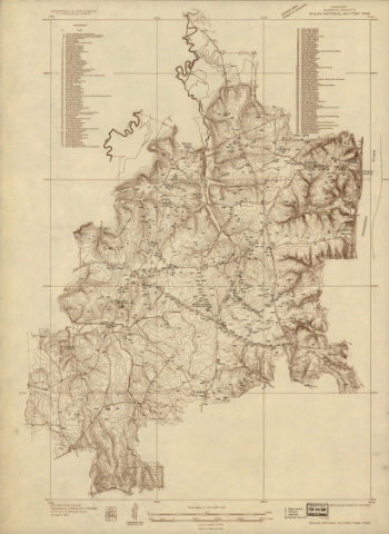
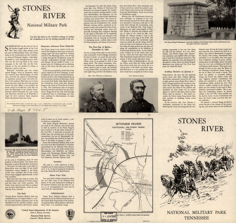
Stones River National Military Park, Tennessee
$17.95 – $47.95 -
From Mitchelsville to Gallatin–Sumner Co.
$17.95 – $47.95 -
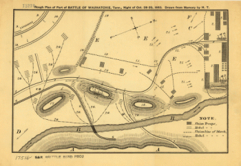
Rough plan of part of battle of Wauhatchie, Tenn.
$17.95 – $47.95 -
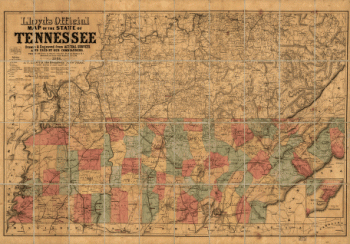
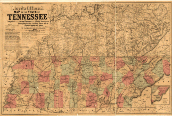
Lloyd's official map of the State of Tennessee
$17.95 – $47.95 -
Lloyd's official map of the State of Tennessee 2
$17.95 – $47.95 -
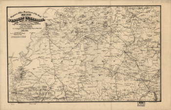
Western Tennessee, and part of Kentucky
$17.95 – $47.95 -
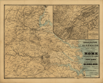
The approaches from Washington to Richmond
$17.95 – $47.95 -
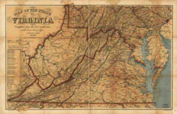
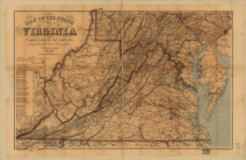
Map of the State of Virginia
$17.95 – $47.95 -
Map of the State of Virginia
$17.95 – $47.95 -
Route of the New River R.R.
$17.95 – $47.95 -
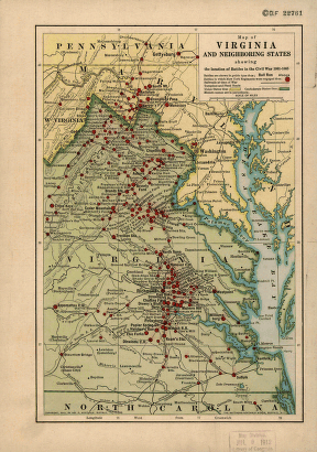
Map of Virginia and neighboring states
$17.95 – $47.95 -
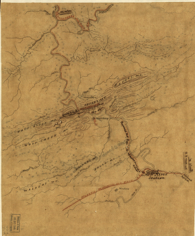
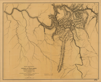
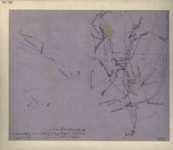
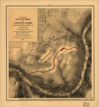
Military reconnaissance in the vicinity of Gauley Bridge
$17.95 – $47.95 -
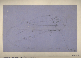
Rich Mountain battlefield, July 11-12, 1861
$17.95 – $47.95 -
Sketch of the battle of Rich Mountain
$17.95 – $47.95 -
Battle of Rich Mt.
$17.95 – $47.95 -
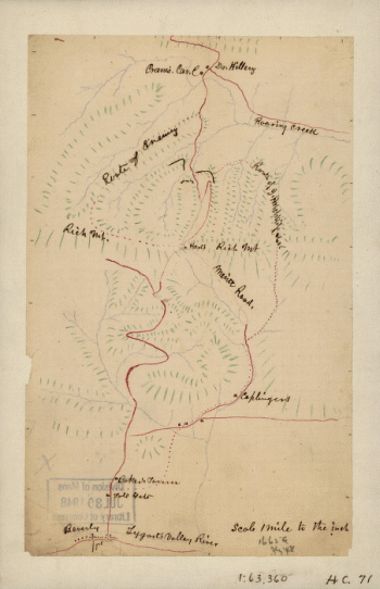
Area of the battle of Rich Mountain
$17.95 – $47.95 -
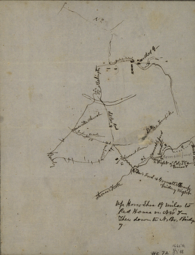
Rough sketch of the Rich Mountain battle area
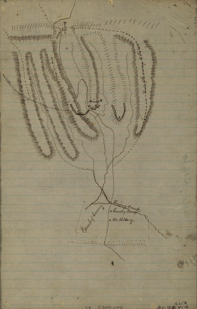
$17.95 – $47.95 -

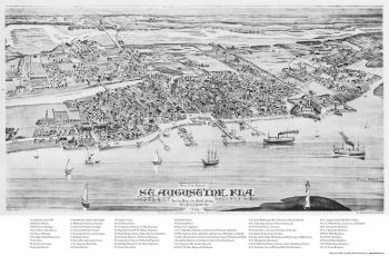
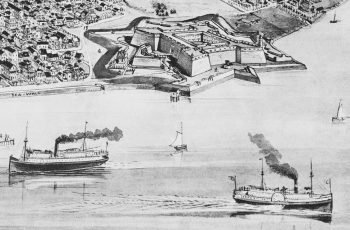
St. Augustine, 1885
$17.95 – $47.95 -
Castillo de San Marcos
$17.95 – $47.95 -
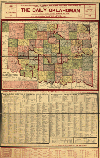
Premier series map of Oklahoma and Indian Territory
$17.95 – $47.95 -
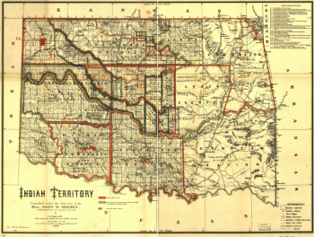
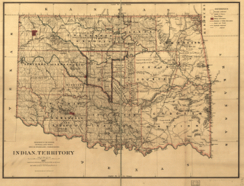
Indian territory
$17.95 – $47.95 -
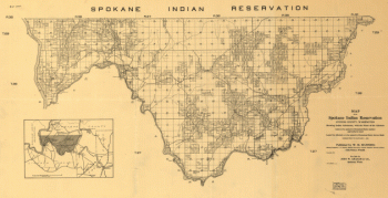
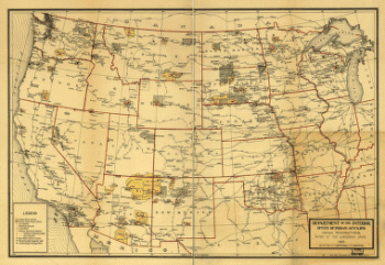
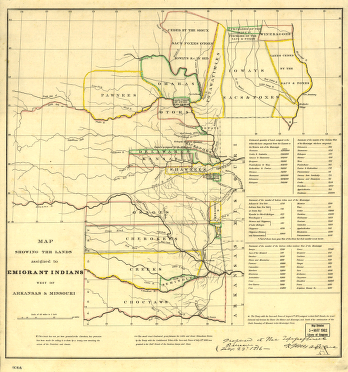
Indian Reservations west of the Mississippi River
$17.95 – $47.95 -
Indian territory
$17.95 – $47.95 -
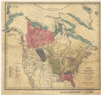
Map of the Indian tribes of North America
$17.95 – $47.95 -
The Monongahela, with the field of battle
$17.95 – $47.95 -
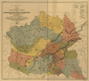
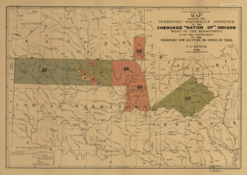
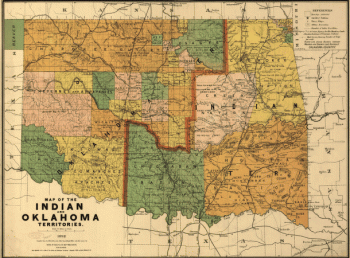
Map of the Indian and Oklahoma territories
$17.95 – $47.95