-

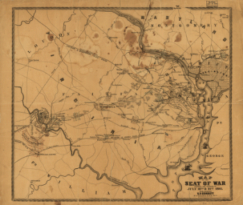
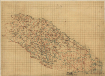
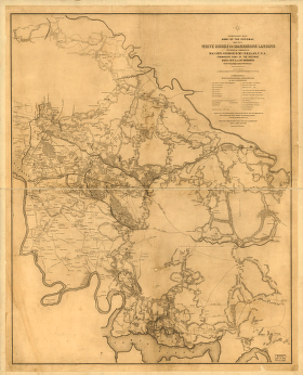
The Seat of War
$17.95 – $47.95 -
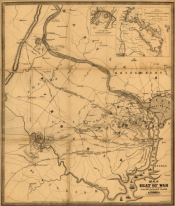
Map of the seat of war
$17.95 – $47.95 -
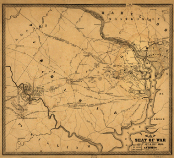
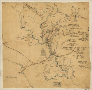
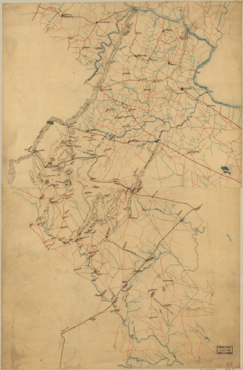
The Seat of War
$17.95 – $47.95 -
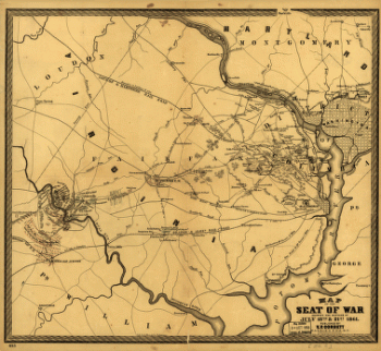
Map of the seat of war
$17.95 – $47.95 -
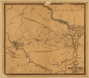
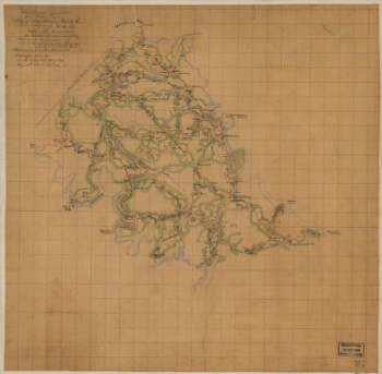
Seat of War
$17.95 – $47.95 -
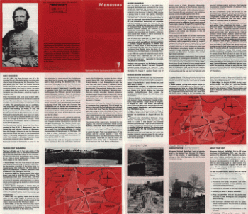
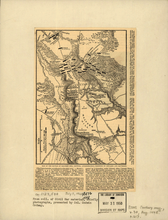
First Manassas
$17.95 – $47.95 -
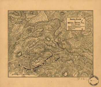
Battle field of Bull Run – July 21st 1861
$17.95 – $47.95 -
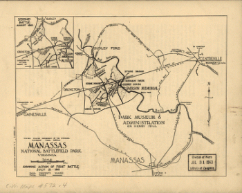
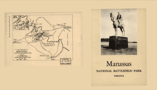
Manassas National Battlefield Park, Virginia
$17.95 – $47.95 -
Manassas National Battlefield Park
$17.95 – $47.95 -
Manassas National Battlefield Park
$17.95 – $47.95 -
Battle of Malvern Hill
$17.95 – $47.95 -
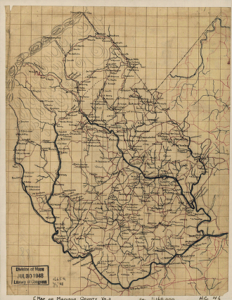
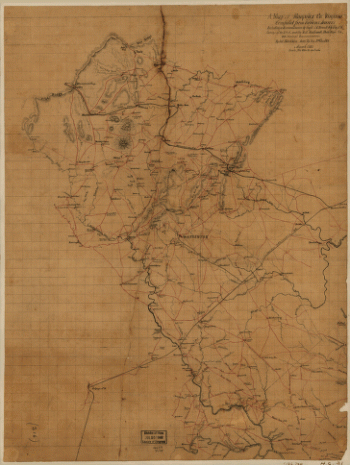
Map of Madison County, Va.
$17.95 – $47.95 -
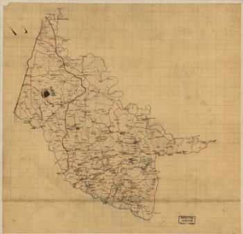
Louisa County and part of Hanover County, Va.
$17.95 – $47.95 -
King William County, Va.
$17.95 – $47.95 -
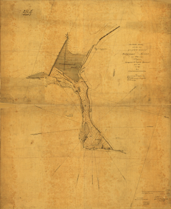
Jones Point, Potomac River, near Alexandria, Virginia
$17.95 – $47.95 -
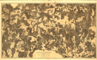
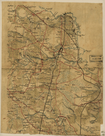
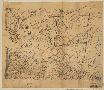
Jetersville and Sailors Creek in 1865
$17.95 – $47.95 -
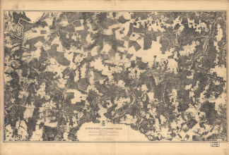
Jetersville and Sailors Creek
$17.95 – $47.95 -
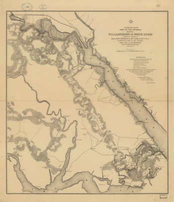
Williamsburg to White House
$17.95 – $47.95 -
Sketch of roads and streams in Highland County, Va.
$17.95 – $47.95 -
White House to Harrisons Landing
$17.95 – $47.95 -
Map of Hanover County, Va.
$17.95 – $47.95 -
Northern portion of Hanover County
$17.95 – $47.95 -
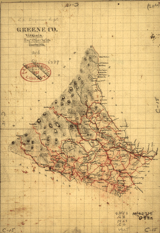
Greene County, Virginia
$17.95 – $47.95 -
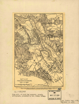
Battle of Fredericksburg. Dec. 13, 1862
$17.95 – $47.95 -
Fredericksburg in Dec. 1862
$17.95 – $47.95 -
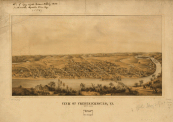
View of Fredericksburg, Va. Nov. 1862
$17.95 – $47.95 -
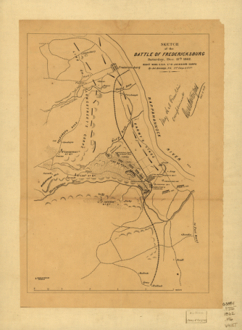
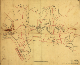
Sketch of the battle of Fredericksburg
$17.95 – $47.95 -
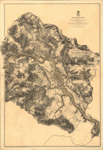
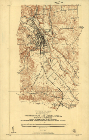
Topographic map of Fredericksburg and vicinity, Virginia
$17.95 – $47.95 -
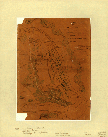
Sketch of the battle field of Fredericksburg
$17.95 – $47.95 -
Approaches of A. of P. to Fredericksburg
$17.95 – $47.95 -
Fredericksburg
$17.95 – $47.95 -
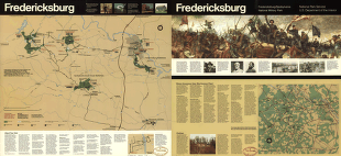
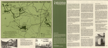
Fredericksburg and Spotsylvania National Military Park
$17.95 – $47.95 -
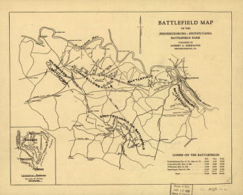
Map of the Fredericksburg-Spotsylvania Battlefield Park
$17.95 – $47.95 -
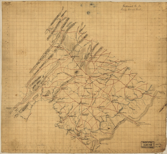
Frederick County from from Wood's map
$17.95 – $47.95 -
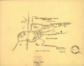
Plan of Fort Sedgwick generally known as Fort Hell
$17.95 – $47.95 -
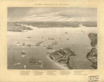
Fortress Monroe, Va. and its vicinity
$17.95 – $47.95 -
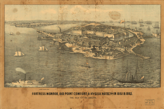
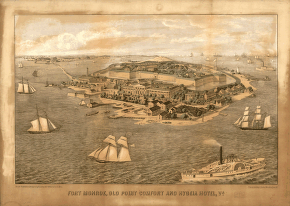
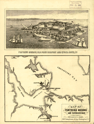
Fort Monroe, Old Point Comfort and Hygeia Hotel
$17.95 – $47.95 -
Map of Fortress Monroe and surroundings
$17.95 – $47.95 -
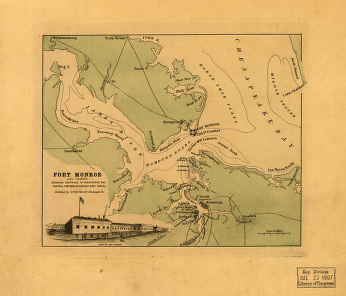
Fort Monroe and vicinity
$17.95 – $47.95 -
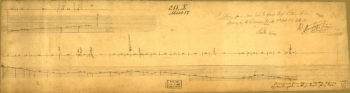
Section from Mary Hall to flags-staff Ethan Allen
$17.95 – $47.95 -
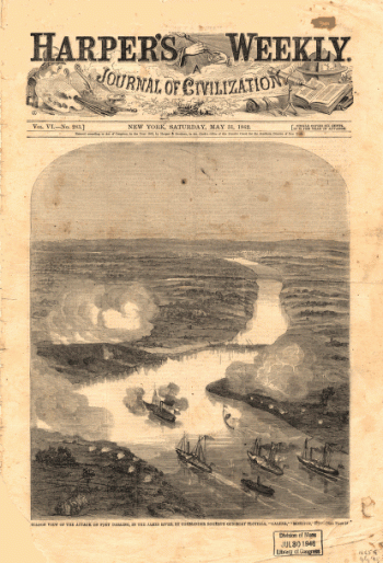
Balloon view of the attack on Fort Darling in the James River
$17.95 – $47.95 -
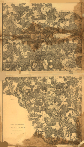
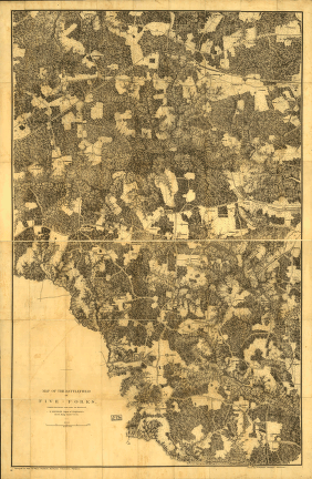
Map of the battlefield of Five-Forks
$17.95 – $47.95 -
The battlefield of Five-Forks
$17.95 – $47.95 -
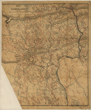
Fauquier & Loudon counties
$17.95 – $47.95 -
Parts of Fauquier, Prince William, and Rappahannock counties
$17.95 – $47.95 -
Fauquier County, Virginia
$17.95 – $47.95