-

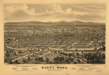
Bird's eye view of Santa Rosa, Sonoma County, Cal., 1876.
$17.95 – $47.95 -
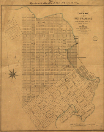
Official map of San Francisco.
$17.95 – $47.95 -
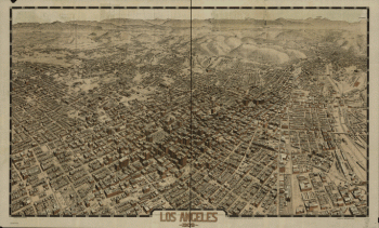
Los Angeles 1909.
$17.95 – $47.95 -
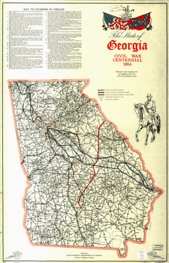
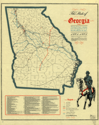
The State of Georgia, Civil War Centennial, 1864
$17.95 – $47.95 -
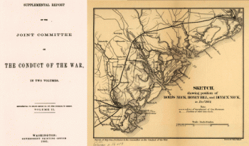
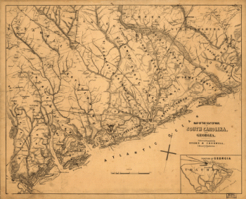
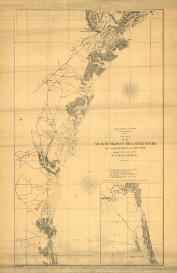
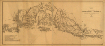
Map of the seat of war, in South Carolina, and Georgia
$17.95 – $47.95 -
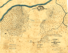
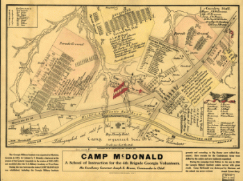
Camp McDonald
$17.95 – $47.95 -
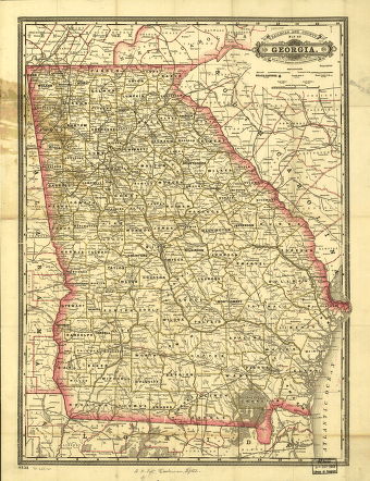
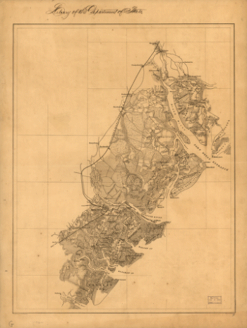
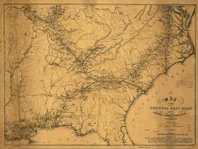
The State of Georgia
$17.95 – $47.95 -
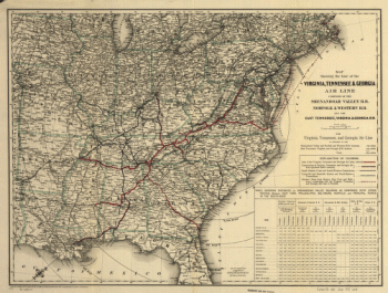
The Virginia, Tennessee, and Georgia Air Line
$17.95 – $47.95 -
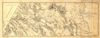
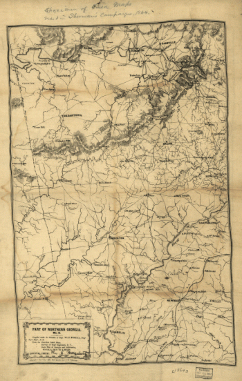
Part of northern Georgia : no. 2
$17.95 – $47.95 -
Line of the Virginia, Tennessee, & Georgia Air
$17.95 – $47.95 -
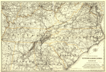
Proposed Tennessee, Alabama, and Georgia Railroad
$17.95 – $47.95 -
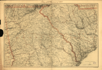
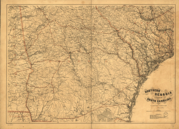
Northern Georgia and western and central South Carolina
$17.95 – $47.95 -
Indexed railroad and county map of Georgia.
$17.95 – $47.95 -
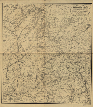
Northwestern Georgia
$17.95 – $47.95 -
The environs of Savannah, Georgia
$17.95 – $47.95 -
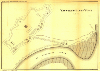
'Causten's Bluff' fort
$17.95 – $47.95 -
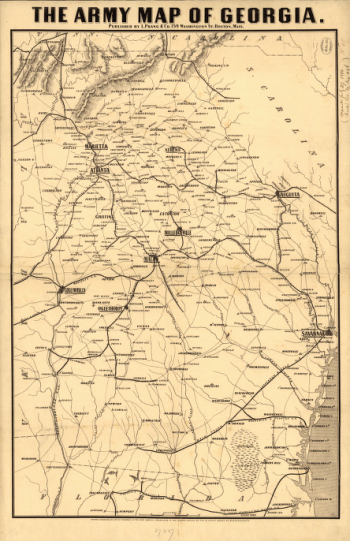
Army map of Georgia
$17.95 – $47.95 -
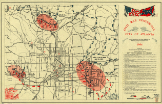
Civil War Centennial, city of Atlanta
$17.95 – $47.95 -
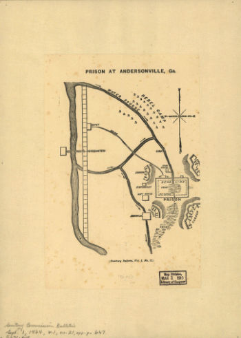
Prison at Andersonville, Ga.
$17.95 – $47.95 -
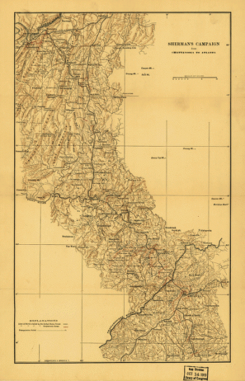
Sherman's campaign from Chattanooga to Atlanta from 1864
$17.95 – $47.95 -
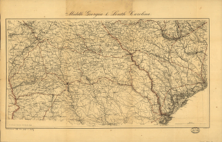
Middle Georgia & South Carolina / U.S. Coast Survey
$17.95 – $47.95 -
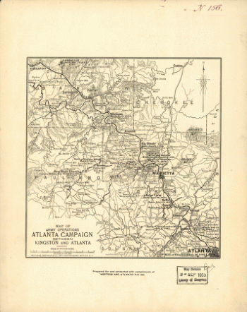
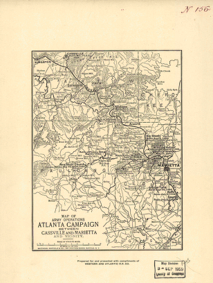
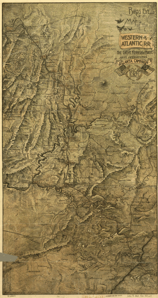
Map of the Atlanta campaign. [May-Sept. 1864].
$17.95 – $47.95 -
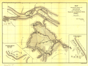
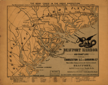
Defences of Savannah
$17.95 – $47.95 -
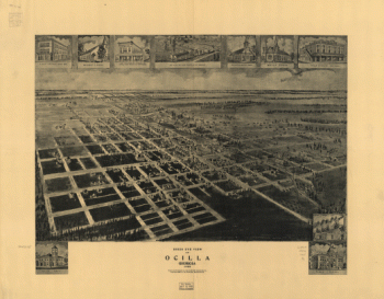
Birds eye view of Ocilla, Georgia 1908.
$17.95 – $47.95 -
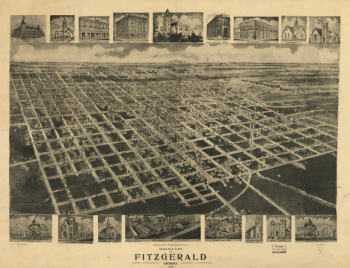
Bird's eye view of Fitzgerald, Georgia 1908.
$17.95 – $47.95 -
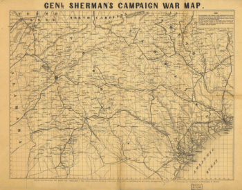
Genl. Sherman's campaign war map.
$17.95 – $47.95 -
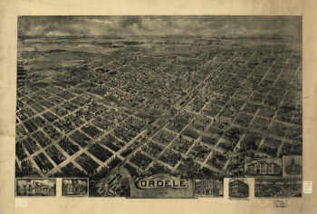
Birds eye view Cordele, Georgia 1908. Drawn by A. E. Downs.
$17.95 – $47.95 -
Fort McAllister, Dec. 1864
$17.95 – $47.95 -
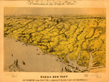
Birds eye view of North and South Carolina and part of Georgia.
$17.95 – $47.95 -
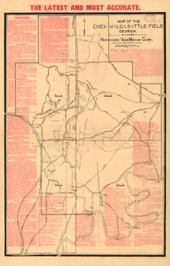
Chickamauga battle-field
$17.95 – $47.95 -
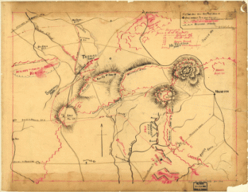
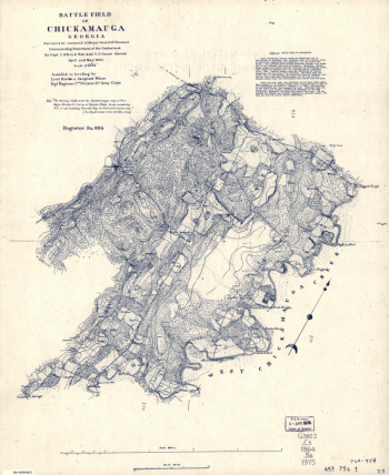
Battle field of Chickamauga, Georgia
$17.95 – $47.95 -
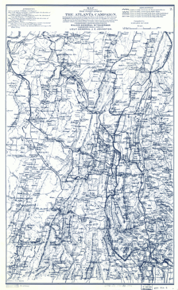
Map illustrating the first epoch of the Atlanta Campaign
$17.95 – $47.95 -
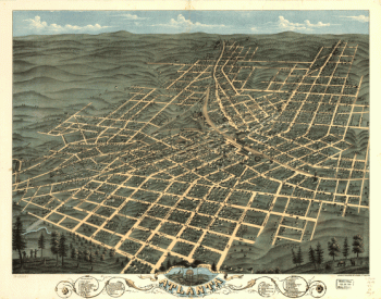
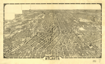
Atlanta.
$17.95 – $47.95 -
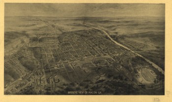
Bird's eye view of Macon, Ga.
$17.95 – $47.95 -
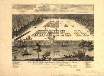
A view of Savannah as it stood the 29th of March 1734.
$17.95 – $47.95

![Map of the Atlanta campaign. [May-Sept. 1864].](https://www.ushistoricalarchive.com/wp-content/uploads/nc/data/products/im/sm/ga/b29.gif)