Home
All Products
Historic Maps
American Indian Maps
Birds Eye View Maps
Civil War Maps
Panoramic Maps
Railroad Maps
Revolutionary War Maps
State Maps
Historic Prints
Civil War Prints
Civil War Posters
Historic Portraits
Presidential Portraits
Contact Us
0
0
press
Enter
to search
Showing all results:
No products found.
Search
Search Product or SKU
×
Sort By
Default
Price: Low to High
Price: High to Low
Alphabetical
SKU
Categories
All
American Indian Maps
American Indian Photos
Birds Eye View Maps
CD Collections
Civil War Maps
Civil War Posters
Civil War Prints
Panoramic Maps
Photo-chromes
Presidential Portraits
Railroad Maps
Revolutionary War Maps
St. Augustine
State Maps
Ypsilanti, Washtenaw Co., Michigan. Drawn & published by A. Ruger.
$
17.95
–
$
47.95
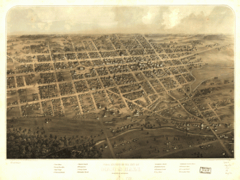
Niles, Berrien County, Michigan. Drawn & published by A. Ruger.
$
17.95
–
$
47.95
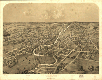
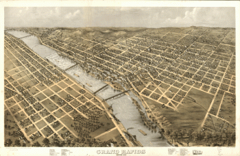
Grand Rapids, Michigan 1868. Drawn by A. Ruger.
$
17.95
–
$
47.95
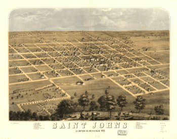
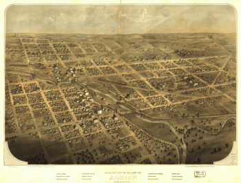
Saint Johns, Clinton Co., Michigan 1868. Drawn by A. Ruger.
$
17.95
–
$
47.95
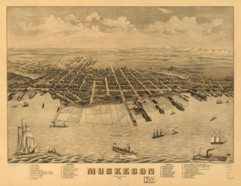
Muskegon, Michigan 1874.
$
17.95
–
$
47.95
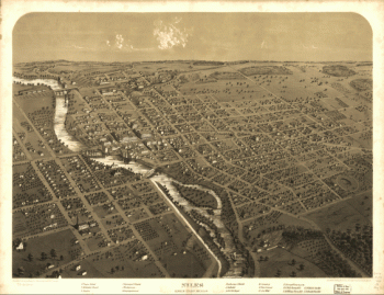
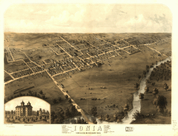
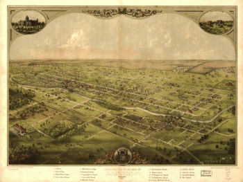
Ionia, Ionia Co., Michigan 1868. Drawn by A. Ruger.
$
17.95
–
$
47.95
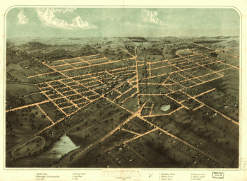
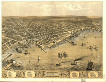
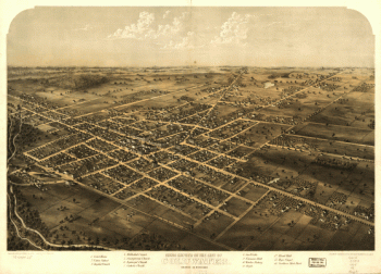
Saginaw City [Michigan 1867] Drawn from nature by A. Ruger.
$
17.95
–
$
47.95
Bird's eye view of the city of Muskegon, Muskegon Co., Michigan 1868. Drawn by A. Ruger.
$
17.95
–
$
47.95
Birds eye view of the city of Marshall, Calhoun Co., Michigan. Drawn & published by A. Ruger.
$
17.95
–
$
47.95
Birds eye view of the city of Coldwater, Branch Co., Michigan. Drawn & published by A. Ruger.
$
17.95
–
$
47.95
Birds eye view of the city of Lansing, Michigan 1866. Drawn & published by A. Ruger.
$
17.95
–
$
47.95
Birds eye view of the city of Albion, Calhoun Co., Michigan. Drawn & published by A. Ruger.
$
17.95
–
$
47.95
Bird's eye view of Bay City, Portsmouth, Wenona & Salzburg, Bay Co., Michigan 1867. Drawn by A. Ruger.
$
17.95
–
$
47.95
Tecumseh, Lenawee Co., Michigan 1868. Drawn by A. Ruger. Chicago Lithogr. Co.
$
17.95
–
$
47.95
Kalamazoo, Michigan 1874. Chas. Shober & Co. props. Chicago Litho. Co.
$
17.95
–
$
47.95
Bird's eye view of Saint Clair, St. Clair Co., Michigan 1868. Drawn by A. Ruger. Chicago Lith. Co.
$
17.95
–
$
47.95
Panoramic view of the city of Ann Arbor, Washtenaw Co., Michigan 1880. Beck & Pauli Lith.
$
17.95
–
$
47.95
Panoramic view of the city of Jackson, Michigan 1881. [By] A. Ruger. Beck & Pauli Lith.
$
17.95
–
$
47.95
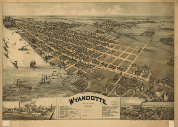
Wyandotte, Michigan 1896. Drawn by T. M. Fowler.
$
17.95
–
$
47.95
Birds eye view of the city of Grand Haven, Ottawa Co., Michigan 1868
$
17.95
–
$
47.95
Mills & manufacturing establishments of the city of Battle Creek, Calhoun Co., Mich
$
17.95
–
$
47.95
Grand Haven, Ottawa County, Michigan 1874. Chas. Shober & Co. props. Chicago Lithographing Co.
$
17.95
–
$
47.95
Proposed route for a rail road from Copper Harbor, to Fond Du Lac, Winnebego.
$
17.95
–
$
47.95
Bird's eye view of Bessemer, Mich., Ontonagon County 1886. Beck & Pauli, litho.
$
17.95
–
$
47.95
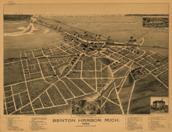
nton Harbor, Mich. 1889.
$
17.95
–
$
47.95
Bird's-eye view of Kalamazoo / this drawing produced by the Benford-Bryan Co. Incorporated, artists.
$
17.95
–
$
47.95
Ironwood, Mich., Ontonagon County 1886. H. Wellge, sk. Beck & Pauli, litho.
$
17.95
–
$
47.95
Panoramic view of Mt. Clemens 1881, Macomb Co., Mich. Beck & Pauli, lith.
$
17.95
–
$
47.95
Chapman's rail road map of Ohio, Indiana, Michigan, Illinois, Missouri, Minnesota, & Wisconsin.
$
17.95
–
$
47.95
Bird's eye view of the city of Battle Creek, Calhoun Co., Mich. Drawn and published by A. Ruger.
$
17.95
–
$
47.95
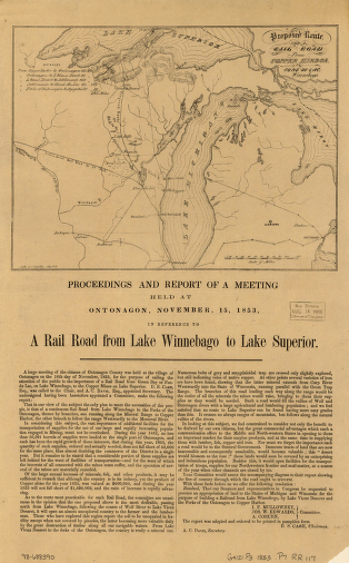
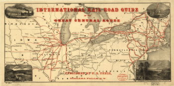
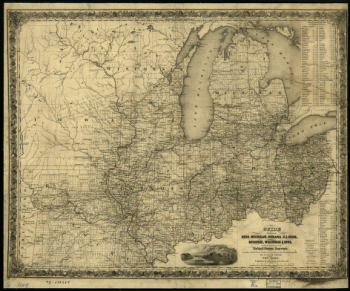
International rail road guide of the Great Central Route.
$
17.95
–
$
47.95
Bird's eye view of Romeo 1868. Drawn by A. Ruger. Chicago Lithogr. Co.
$
17.95
–
$
47.95
An accurate map of the English colonies in North America, bordering on the river Ohio.
$
17.95
–
$
47.95
Bird's eye view of Kalamazoo, Mich. 1883. Drawn by H. Wellge & A. F. Poole. Beck & Pauli, lithographers.
$
17.95
–
$
47.95
Birds eye view of the city of Hillsdale, Hillsdale Co., Mich. 1866. Drawn & published by A. Ruger.
$
17.95
–
$
47.95
Guide through Ohio, Michigan, Indiana, Illinois, Missouri, Wisconsin & Iowa
$
17.95
–
$
47.95
Map showing the Grand Rapids & Indiana Railroad, and its connections.
$
17.95
–
$
47.95
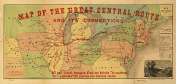
Map of the Great Central Route and its connections
$
17.95
–
$
47.95
Railroad map of New Hampshire accompanying report of the railroad commissioners, 1894.
$
17.95
–
$
47.95
An Accurate map of New Hampshire in New England, from a late survey.
$
17.95
–
$
47.95
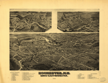
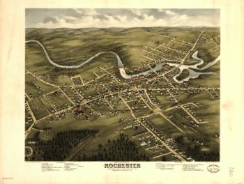
Rochester, N.H., Gonic and East-Rochester, 1884. H. Wellge, del.
$
17.95
–
$
47.95
Peterborough, N.H. 1886. Drawn and published by L. R. Burleigh. Burleigh Lith. Establishment.
$
17.95
–
$
47.95
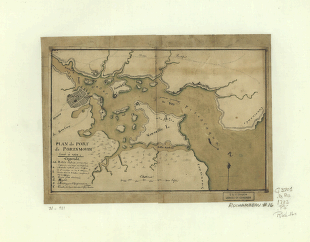
Plan du port de Portsmouth levé à vue.
$
17.95
–
$
47.95
Bird's eye view of the village of Farmington, Stafford County, New Hampshire 1877.
$
17.95
–
$
47.95
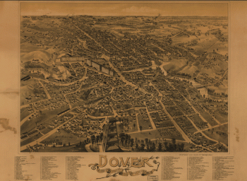
Dover, Stafford County, New Hampshire 1888.
$
17.95
–
$
47.95
Exeter, New Hampshire, 1896. Compliments of the Exeter News-letter.
$
17.95
–
$
47.95
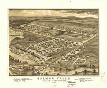
Salmon Falls, Strafford Co., New Hampshire 1877.
$
17.95
–
$
47.95
Bird's eye view of Rochester, Strafford County, New Hampshire, 1877 : from a position, east of town / pub. by J. J. Stoner ; C. H. Vogt & Co., lith., Milwaukee.
$
17.95
–
$
47.95
1
2
3
…
82
83
84
85
86
87
88
…
206
207
208
Load More
All products loaded.
Search Product or SKU
×
Home
All Products
Historic Maps
American Indian Maps
Birds Eye View Maps
Civil War Maps
Panoramic Maps
Railroad Maps
Revolutionary War Maps
State Maps
Historic Prints
Civil War Prints
Civil War Posters
Historic Portraits
Presidential Portraits
Contact Us
Cart
0
Cart
Close
Updating…
No products in the cart.
Continue shopping