par le Sr. Robert de Vaugondy, Géog. Ord. du Roi … et Censeur Royal. Robert de Vaugondy, Gilles, 1688-1766. CREATED/PUBLISHED Paris : Chez Fortin, Ing'r mécanicien du Roi pour les globes et sphères, 1778. NOTES Covers Canada east of Lake Superior and south of James Bay; covers U.S. north of Albemarle Bay (N.C.). Relief shown pictorially. Meridians numbered eastward from unspecified prime (Montréal at 3050E). Believed to be the earlist map to use the name United States of America (in any language). Includes Newfoundland inset and pictorial title cartouche.

Carte du Canada et des Etats-Unis de l'Amérique Septentrionale
$17.95 – $47.95
SKU: smcan24
Related products
-

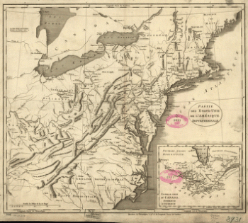
Partie des États-Unis de l'Amérique septentrionale
$17.95 – $47.95 -
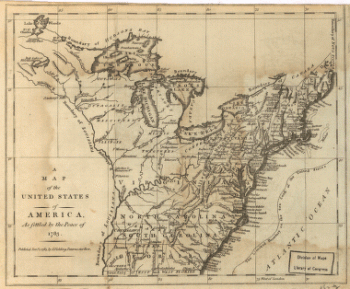
United States of America, as settled by the peace of 1783.
$17.95 – $47.95